Uskedalen
Hike to Solfjell
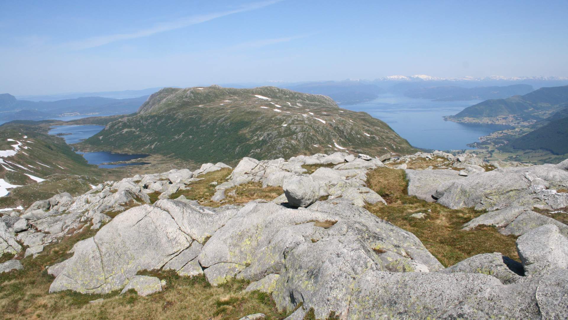
There is a beautiful panorama view from the top.
Uskedalen.
MapFolgefonna National Park
Start and stopping pointThe bus stop at highway 48, approx. 150 meters north of the gas station, towards Rosendal.
ParkingBy the old school in the town center. Large parking lot with an information board for Uskedalen.
MarkingInformation board by the bus stop. T markings and signs.
GradingRed, moderate hike, three boots according to the DNT system.
Difference in altitude20 - 900m AMSL
Estimated time5 hours round trip
Recommended adviceThere are few places to find drinking water before getting close to the top. From Solfjell, you may go eastward, down to Mannsvatnet Lake.
OverviewGravel road up through the subdivision to a path up the hill via Ådnaklett and Storhaug. From Storhaug towards Mannsvatnet Lake, you can see the characteristic moraine ridges. Leave the path to Mannsvatnet Lake by the sign for Solfjell. The last part of the hike has a steep incline. There is a beautiful panorama view from the top.
Last updated: 01/29/2024
Source: Samarbeidsrådet for Sunnhordland
Hike to Solfjell