stryn
Gryta
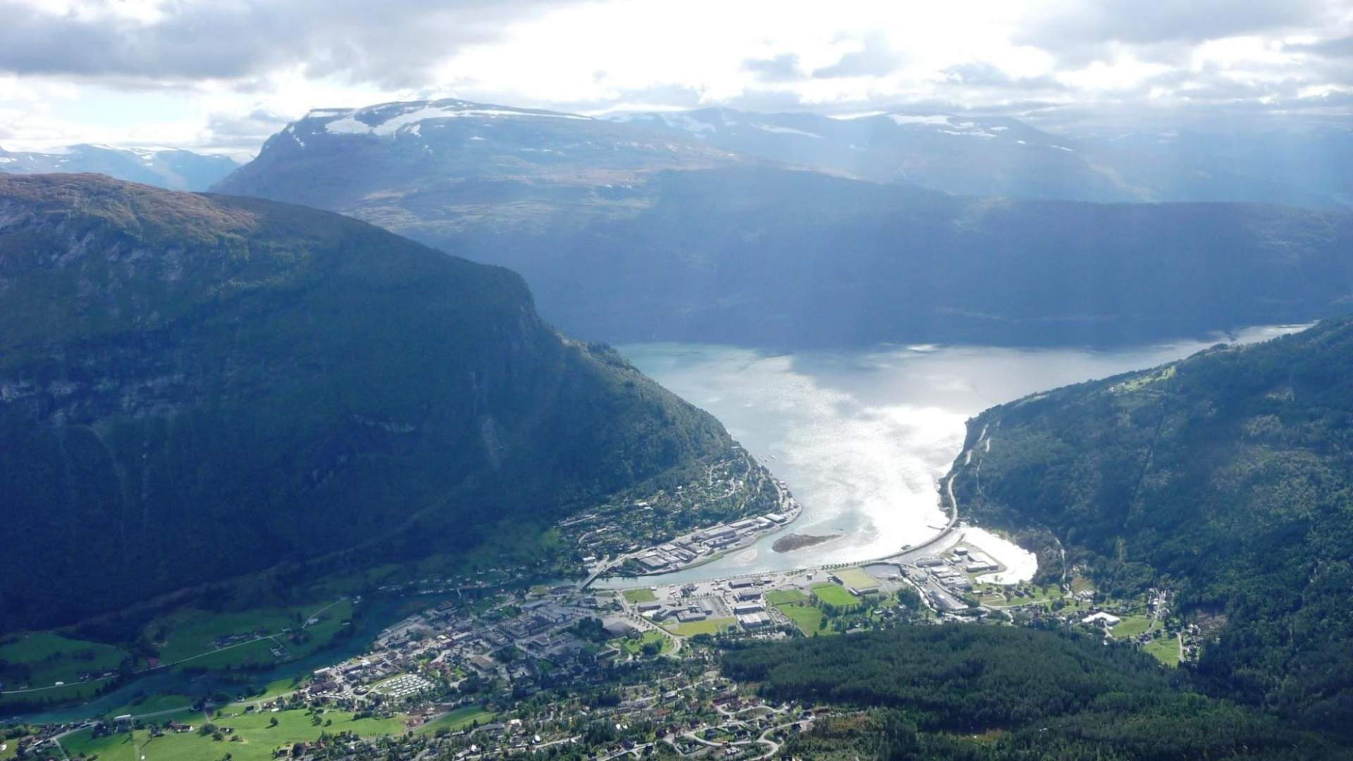
Gryta lies just north of Stryn town centre. From the top you have a great view over the centre of Stryn, several mountain tops, the Jostedalsbreen Glacier, Lake Hornindalsvatnet, Lake Stryn and the Nordfjord.
This popular route follows a good, dry, child-friendly path a large part of the way. It starts with a steep incline above a mountain farm until you get above the tree line, then ascends gently in a south-easterly direction before veering north-east along a shelf halfway up the mountain. Finally, you turn south up a fairly steep slope to reach the summit.
There is an outstanding viewpoint at an altitude of 960 metres above sea level just south of the summit. Local walkers sometimes take the alternative route up Marakråna, wich follows a narrow, exposed mountain path up through the crags and cliffs on the south side of the mountain. This trail is not marked.
A third alternative is to take the route to Bubergskaret at the north side of the summit. This route is less steep, but somewhat longer. Marked trail.
http://www.nordfjord.no/fjordtrails
Source: Nordfjord
Gryta