There was not an exact match for the language you toggled to. You have been redirected to the nearest matching page within this section.
Scandic Hotels – in all major cities from north to south
Nordic Choice Hotels – a different hotel company
Thon Hotels – with fantastic breakfast
Hostelling International – the door to Norway
Radisson Blu Hotels – discover your favourite destinations
Widerøe – the largest regional airline in Scandinavia
AutoEurope – always a smooth car rental experience
Vy express – travel with bus throughout Norway
DFDS – Europe’s leading ferry operator 2012-2020
Rent-A-Wreck – the smart car rental alternative
Arctic Campers – Norway’s camper van rental
NOR-WAY Bussekspress – travel green with express busses
Vy – it should be easy to travel green
Hurtigruten – "The World’s Most Beautiful Sea Voyage"
Authentic Scandinavia – exciting Norway tours
Up Norway – tailored journeys
Norrøna Hvitserk – expeditions and adventure holidays
Fjord Tours – experience Norway in a nutshell® with one ticket
50 Degrees North – unforgettable tailor-made and small group tours to Norway
Discover Norway – skiing, biking and hiking tours in Norway
Norwegian Holidays – low-price package holidays with Norwegian. Flight, hotel and rental car
DanCenter – your specialist in holiday homes in Norway
Norgesbooking – book your perfect cabin stay in Norway
{{title}} {{:price}} - {{!preprice}} Price: {{?}} {{preprice}} {{/}} {{price}} {{:postprice}}{{postprice}}{{/}} {{?:pricing}} - {{pricing}} {{/pricing}}
Location
Omvikdalen
Map
Folgefonna National Park
Start and stopping point
Hjelmeland with ”Nistovetunet" - protected historic farm yard.
Parking
The sign by the highway is pointing up to the parking by the new large barn “Revuro”.
Marking
There are signs and an information board by the parking lot.
T marked to Kvanto from the sign by the end of the road at approx. 600m AMSL.
Grading
Red
Moderate hike, three boots according to the DNT system.
Difference in altitude
100 - 992m AMSL
Estimated Time
4 -5 hours round trip
Recommended advice
Few places have as harsh a climate as the area around Kvannto, and the map name Verhardo (harsh climate) seems appropriate.
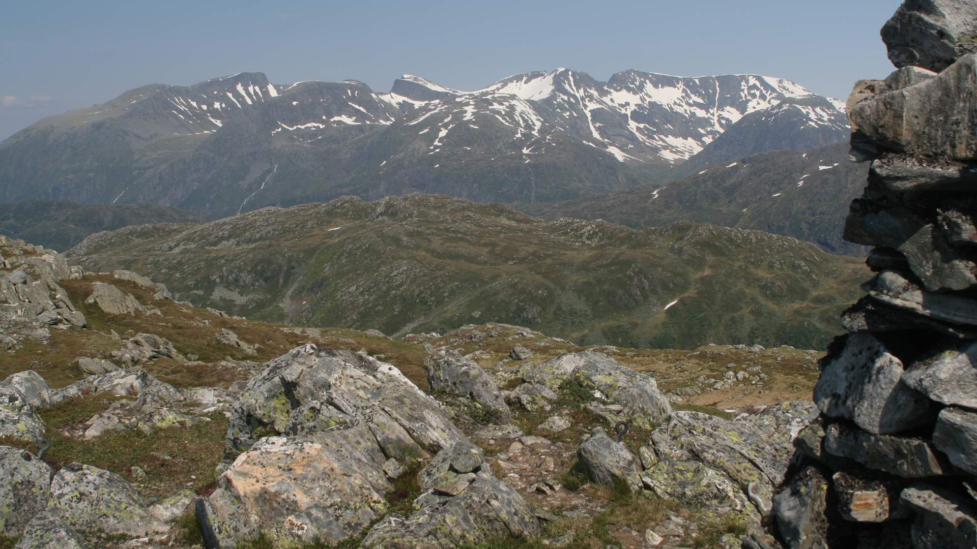
Overview
There is an easy incline from the parking lot to the end of the forest road where the terrain flattens at approx. 600m AMSL. From here there are signs and T marking towards the south, first with a slight incline and then steeper up the ridge to the top where there is a cairn at Kvannto. There is a beautiful view of the mountains and Sunnhordland.