Hike to Nonshaug
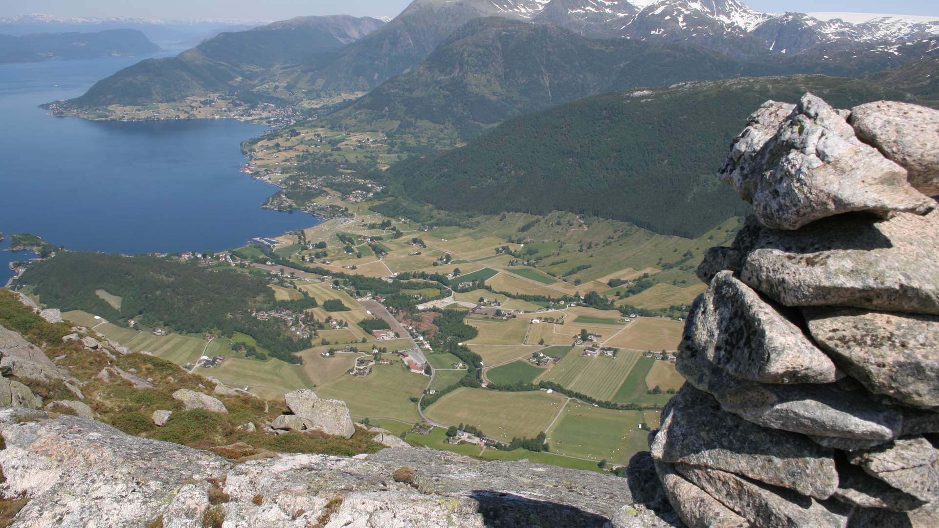
From Nonshaug there is a beautiful view of the best developed agricultural area in Kvinnherad.
Omvikdalen
MapFolgefonna National Park
Start and stopping pointRipel
ParkingBy Omvikdalen school
MarkingT markings from the intersection by Ripel where there are signs and an information board.
GradingRed. Moderate hike, three boots according to the DNT system.
Difference in altitude60 - 810m AMSL
Estimated time4 hours round trip
Recommended adviceThere is a T marked path from Nonshaug towards the south to Tverrfjell. See the route description for Tverrfjell. Be creative and use your imagination to plan interesting hikes.
OverviewFrom the parking lot by Omvikdalen school along the highway going south for approx. 200 meters to the intersection by Ripel where the route begins. Follow the road on the outlying fields and past two gates up to the turn before the end of the road at approx. 350m AMSL. Please remember to close all gates behind you! The sign to Nonshaug at the right side of the road is pointing to the path. For the first 100 meters, the path goes through a spruce forest and continues in more open terrain up to Krukestøl where the farm, upper Sandvik, was located in its time. Continue up to Nonshaug and the rock cairn at the eastern most top towards Omvikdalen.
There is a beautiful view of the best developed agricultural area in Kvinnherad. Return the same way
Source: Samarbeidsrådet for Sunnhordland
Hike to Nonshaug