Hike to Vardhaugselet from Valen

Nice walk to Varhaugselet - with a terrific view.
Valen.
MapFolgefonna National Park
Start and stopping pointThe Søsterheimen, Valen hospital
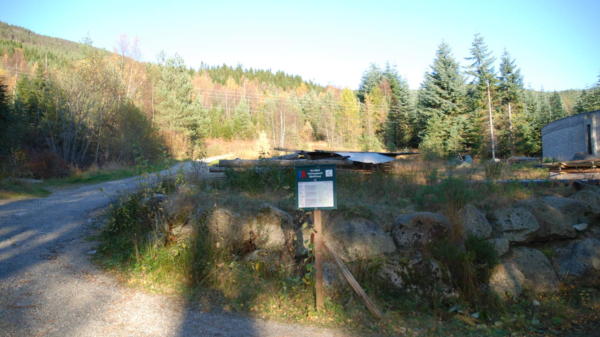
ParkingDrive into the hospital area from the highway and follow the signs for 300 meters to the Søsterheimen.
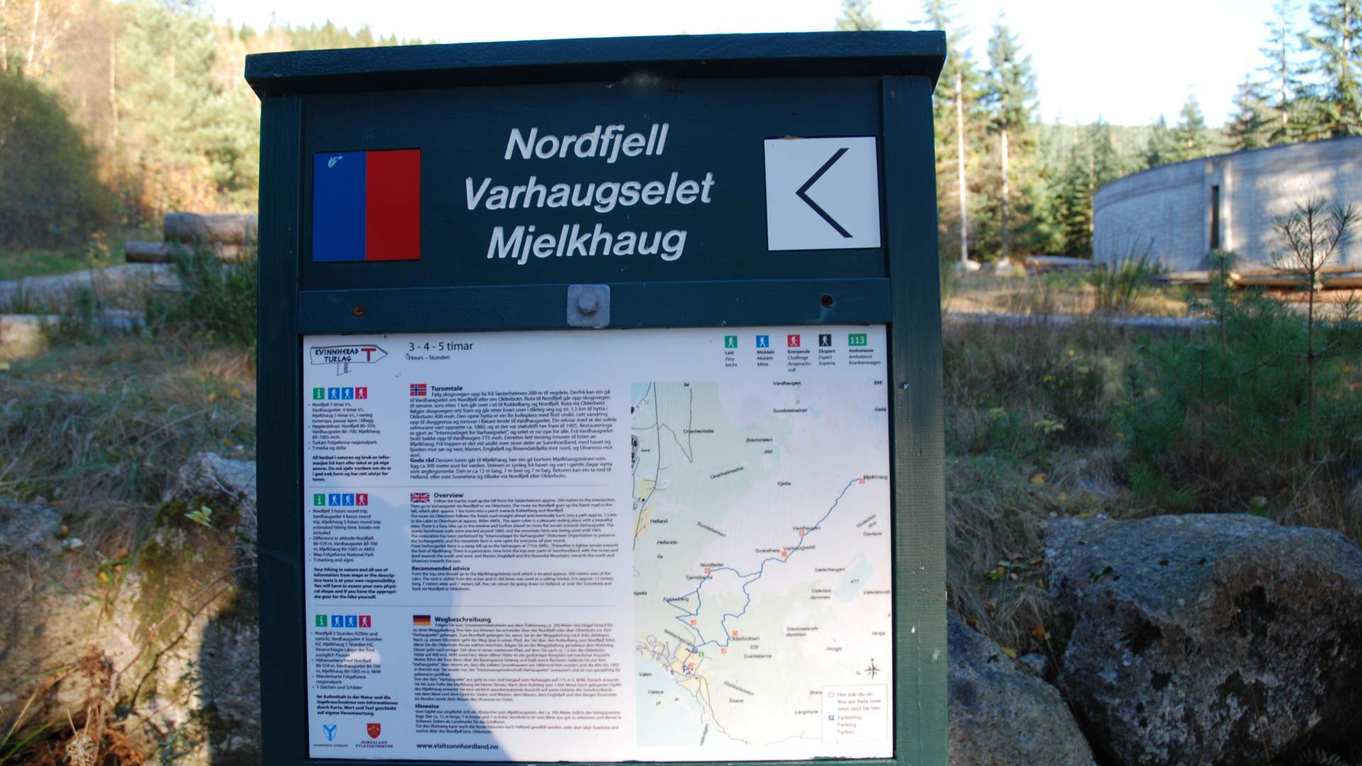
MarkingT markings and signs. Information Board by the starting point.
GradingRed Moderate hike, two boots according to the DNT system.
Difference in altitude80 - 700m AMSL
Estimated time4 hours round trip
Recommended adviceThe hike to Varhaugselet may be expanded to Vardhaugen and Mjelkhaug. You may want to plan the upwards trip as a round trip to Nordefjell and alternatively Olderbotnen.
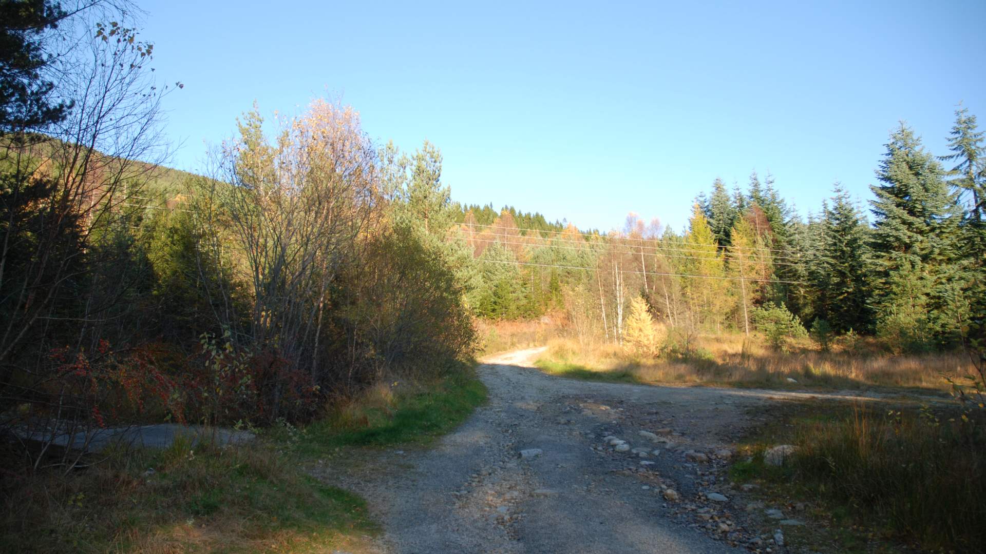
OverviewFollow the forest road up the hill from Søsterheimen for 200 meter to the intersection. Then go to Varhaugselet via Nordfjell or via Olderbotn. The route via Nordefjell goes up the forest road to the left, which after 1 km turns into a path towards Kokkelberg and Nordefjell. The route via Olderbotn follows the forest road straight ahead and eventually turns into a path 1.5 km to the cabin in Olderbotn, 400m AMSL.
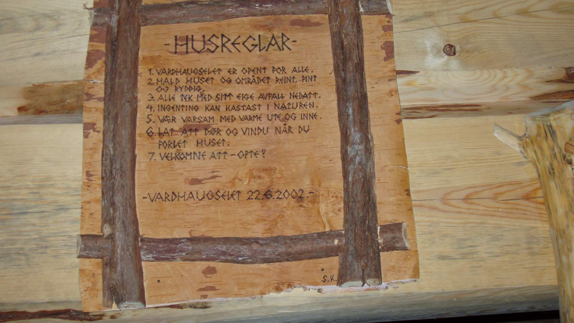
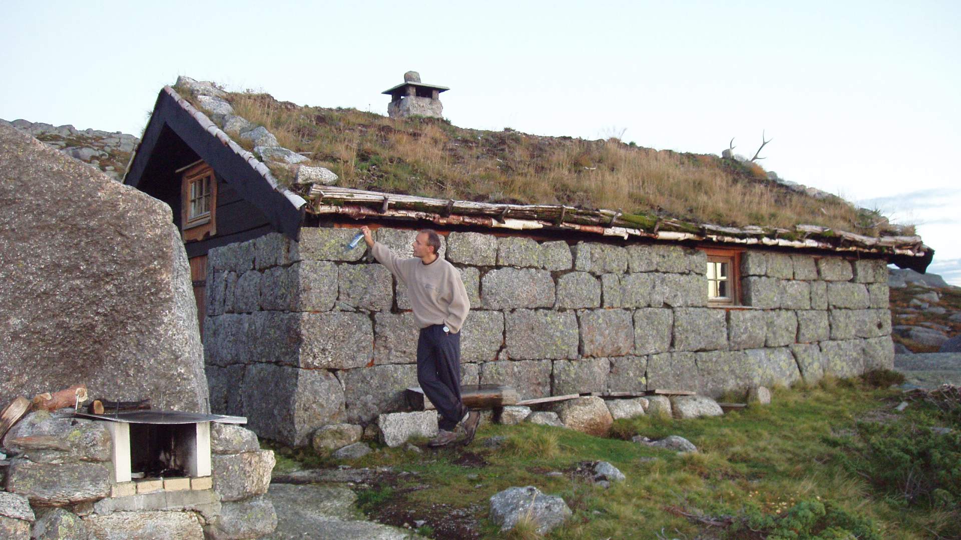
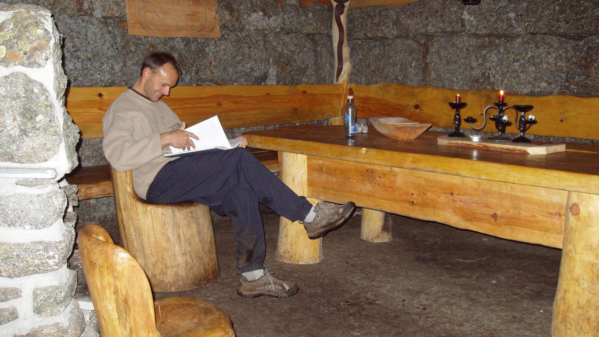
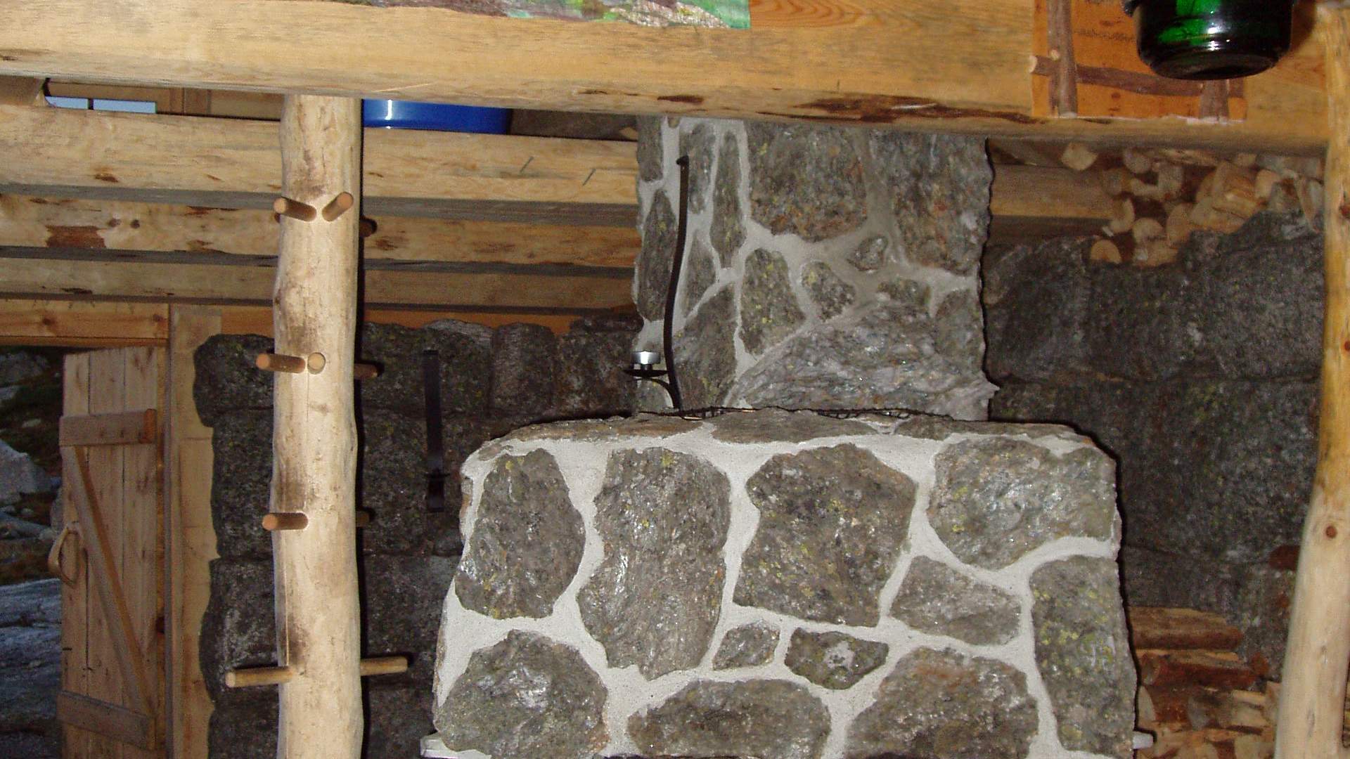
The open cabin is a pleasant resting place with a beautiful view. There is an easy hike up to the treeline and further ahead on more flat terrain towards Varhaugselet. The sturdy farmhouse walls were erected around 1860, and the mountain farm was being used until 1905.
The restoration has been performed by "Interesselaget for Varhaugselet" (Volunteer Organization to preserve the Varhaugselet), and the mountain farm is now open for everyone all year round.
Source: Samarbeidsrådet for Sunnhordland
Hike to Vardhaugselet from Valen