Drive through heritage landscapes dotted with summer mountain farms, and enjoy the views while going over Norway's second highest mountain pass. The setting for this scenic route provides the perfect starting point for mountain hiking in the Jotunheimen mountains, where traditional mountain food awaits in scenic locations.
Norwegian Scenic
Route Valdresflye
Drive through spectacular nature above the tree line
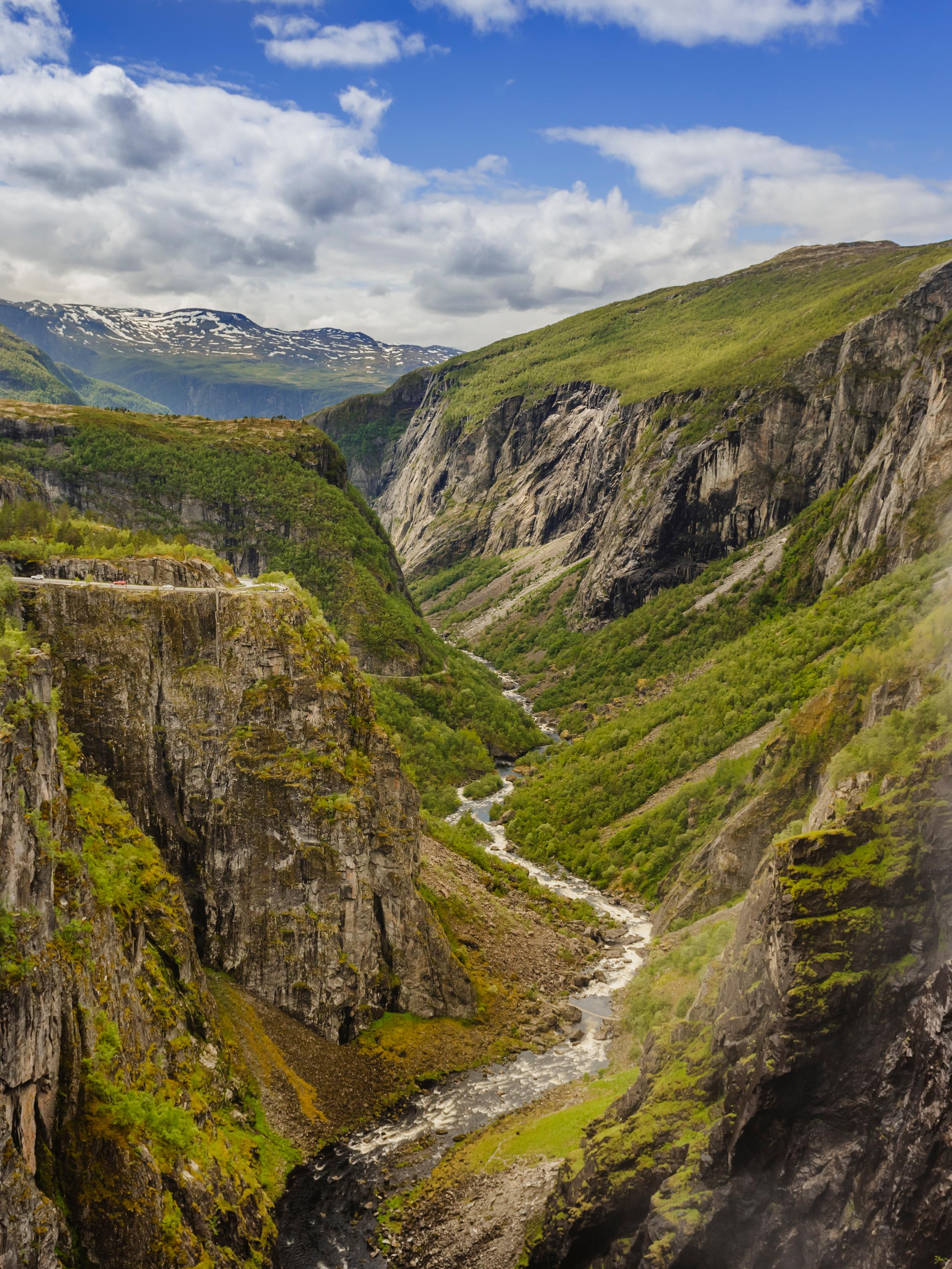
The Norwegian Scenic Route Valdresflye, one of 18 Norwegian Scenic Routes, runs through the mountain plateau and provides excellent views of Jotunheimen National Park.
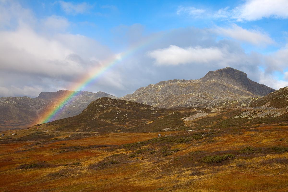
A scenic drive across Valdresflye
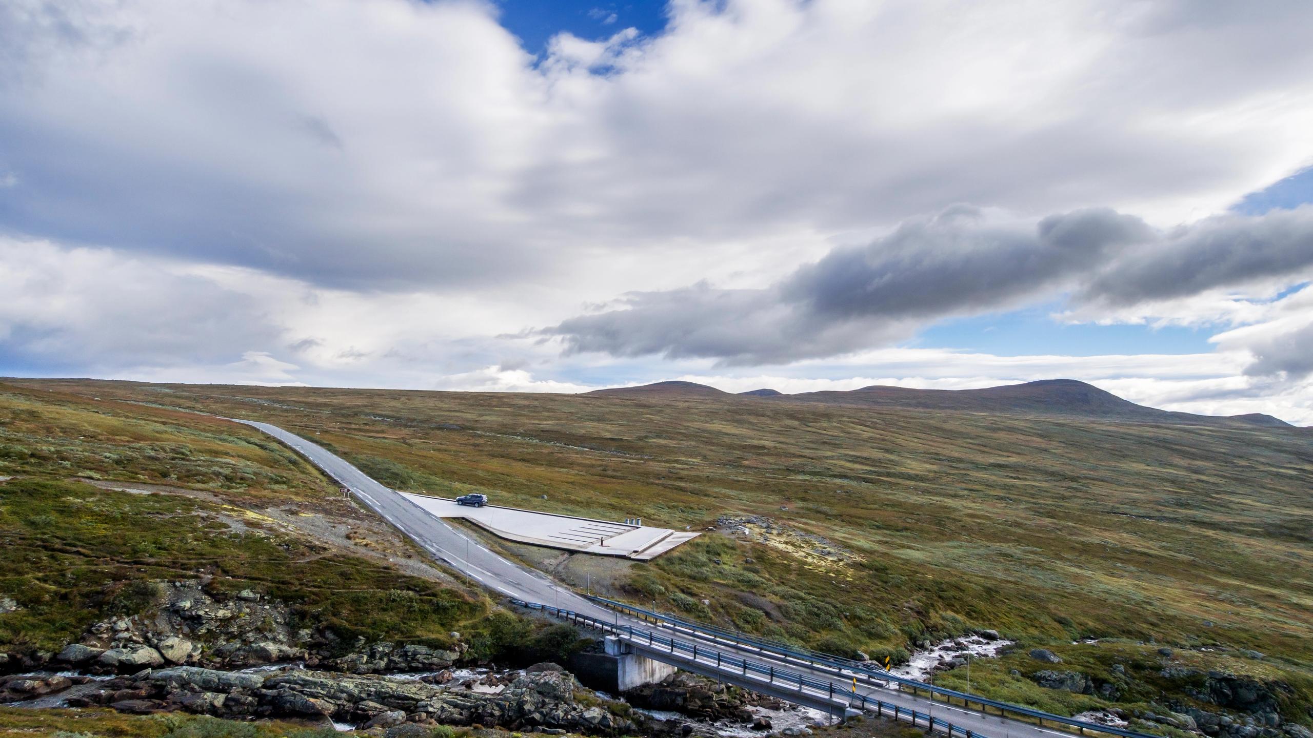
This incredible route takes you 49 kilometres across Valdresflye, between Garli (near Beitostølen in Valdres) and Besstrondsæter in Vågå.
The road's highest point, 1,389 metres above sea level, provides a fantastic view of the mountains, and there are several viewpoints where you can stop along the way.
It also takes you to Gjende, where you'll find the starting point for the Besseggen hike.
Note that the whole road is usually open from around the beginning of April until mid-November, depending on snow and weather conditions. The stretch between Vågå and Gjendesheim, the northern part of the route, is open all year.
Note: The use of electric bicycles, regardless of whether the motor is running or not, is prohibited in nature, and on all trails and country roads through nature. This ban was introduced to protect vulnerable wildlife, fauna and other trail users. However, cycling on cycle routes, such as the popular Mjølkevegen, is allowed. Please check the local tourist information office for more details before setting out.
By car: If you start from Oslo or Bergen, you can follow the E16 road to Beitostølen and Garli. From Trondheim, follow the E6 road. You can plan your route, find traffic alerts and more at Statens Vegvesen.
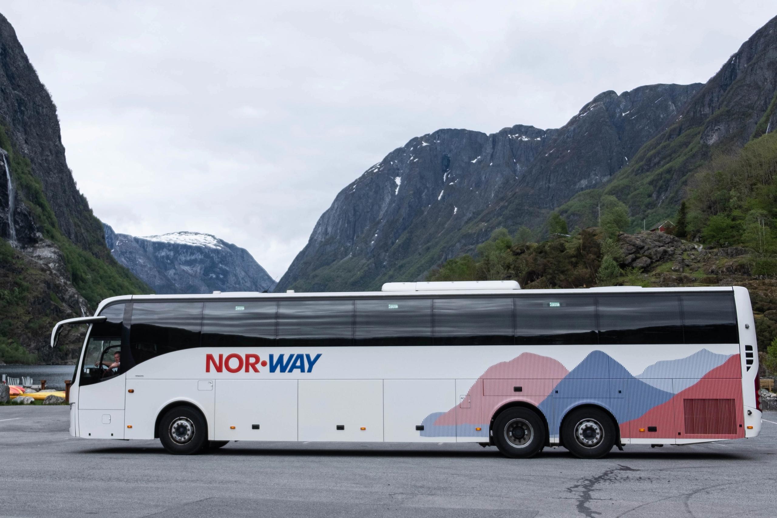
By public transport: The Valdresekspressen bus operated every day, all year round, and drive between Oslo, Fagernes and Beitostølen. During summer, the route is extended with additional departures to Gjendesheim. The season runs from June 7th to October 6th.
You can book plane tickets with Norwegian, Widerøe, or SAS.
Let's follow the route from south to north!
But before you start your scenic drive from Beitostølen, you first get to enjoy the ride through the lush Valdres region.
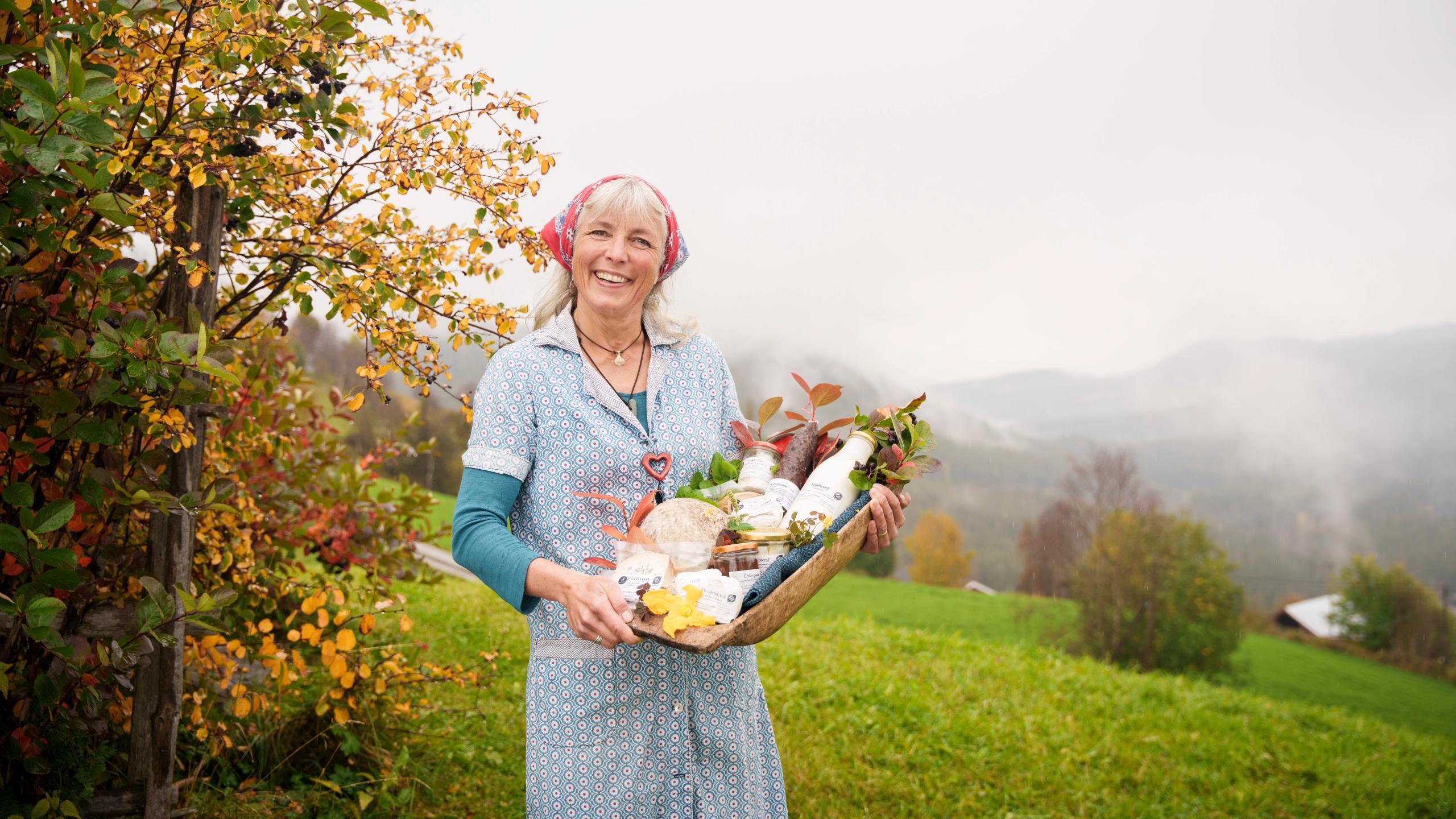
No other area in Northern Europe has so many summer mountain farms in operation as right here in the Valdres region.
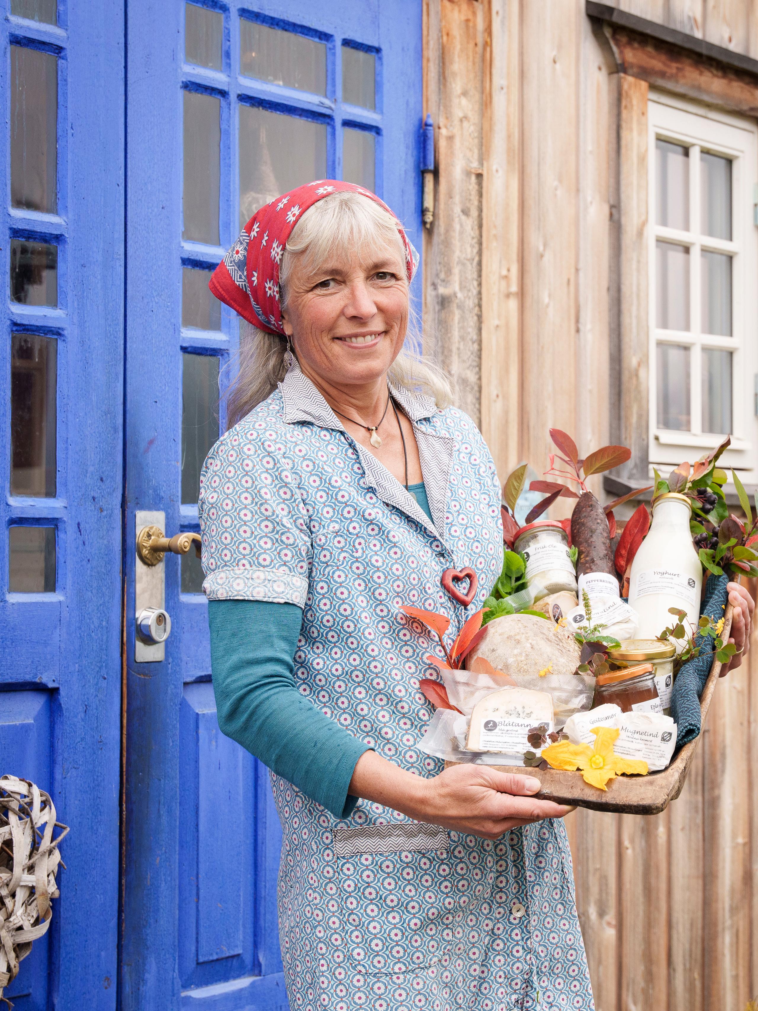
That means plenty of farm cafés and shops, and cosy overnight stays where you can have a real taste of the mountains.
Make sure to try the local speciality Kurv, a cured sausage that makes the perfect salty snack.
Follow county road 51 to Beitostølen.
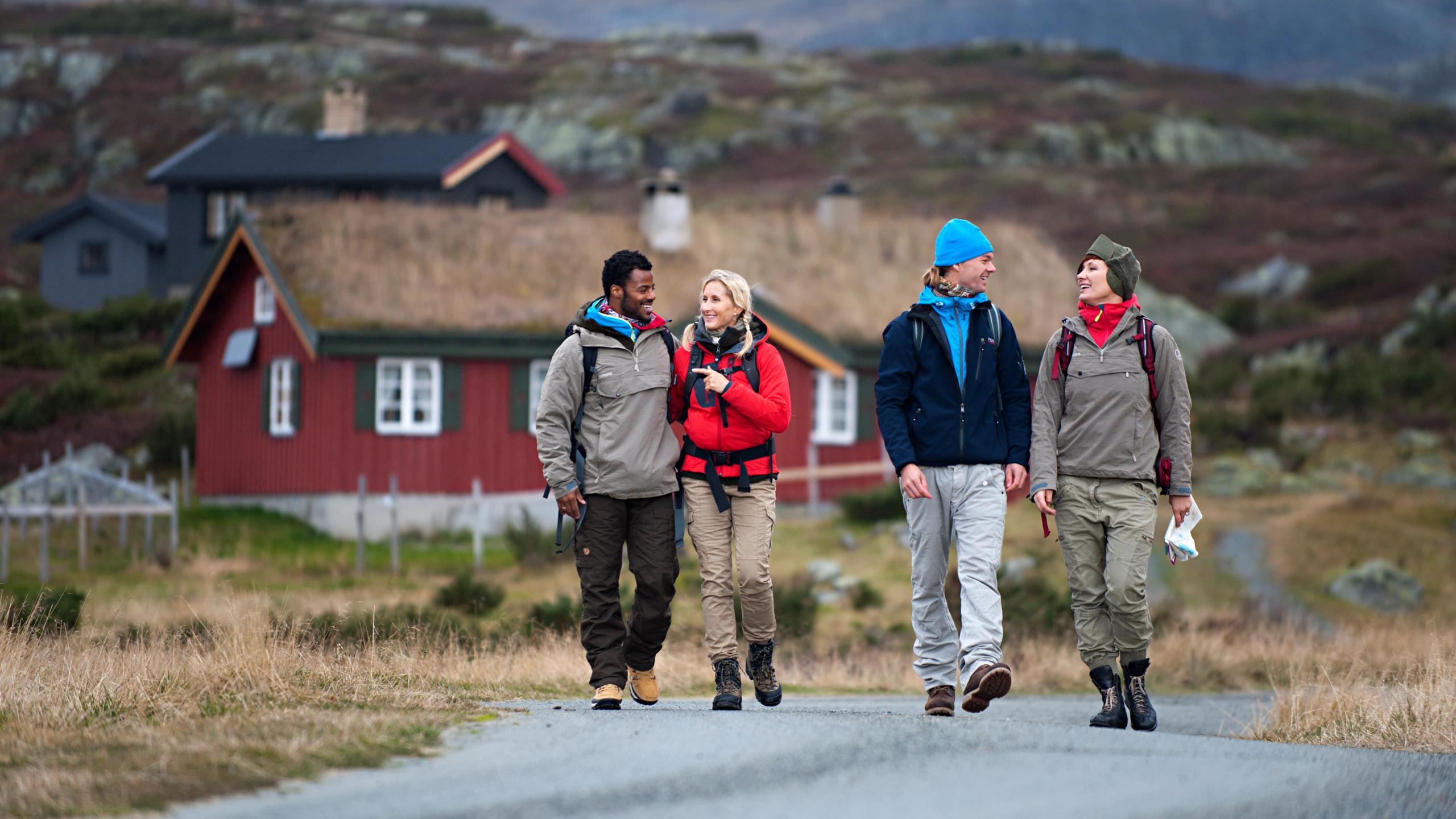
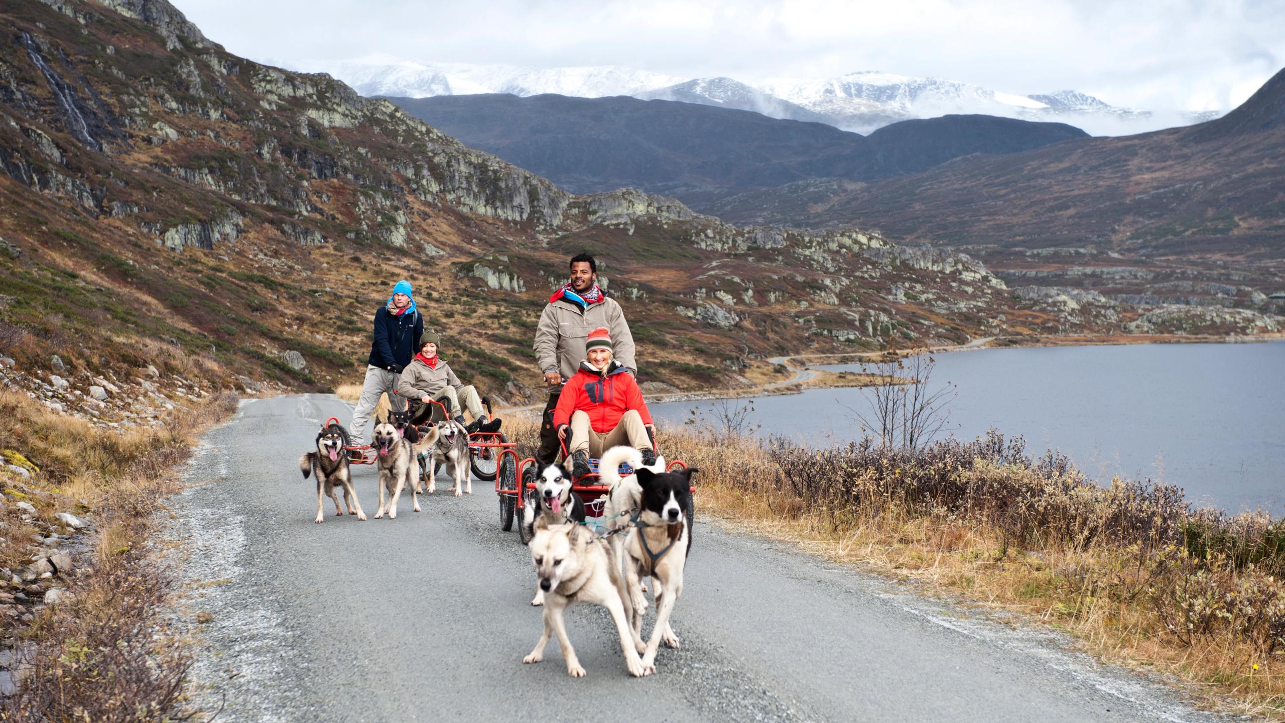
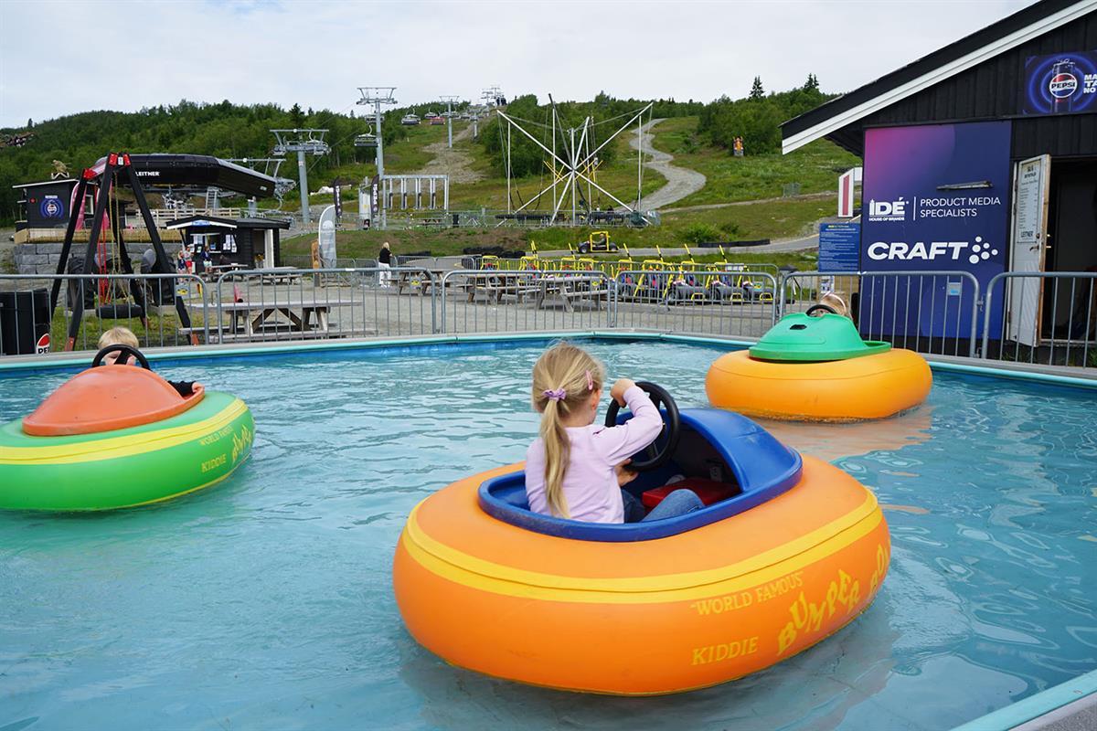
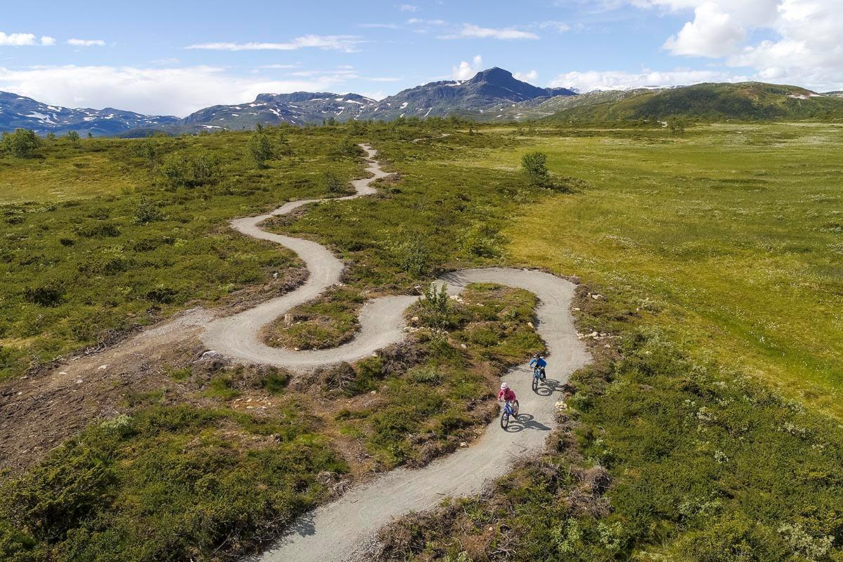
This area is a paradise for activities year round, and a perfect place to use as a base for exploring the outdoors.
Go dog sledding on wheels, try rock climbing, and explore the many scenic cycling and hiking routes – to mention just a few things!
There are also plenty of hotels, cabins, and camping areas where you can stay.
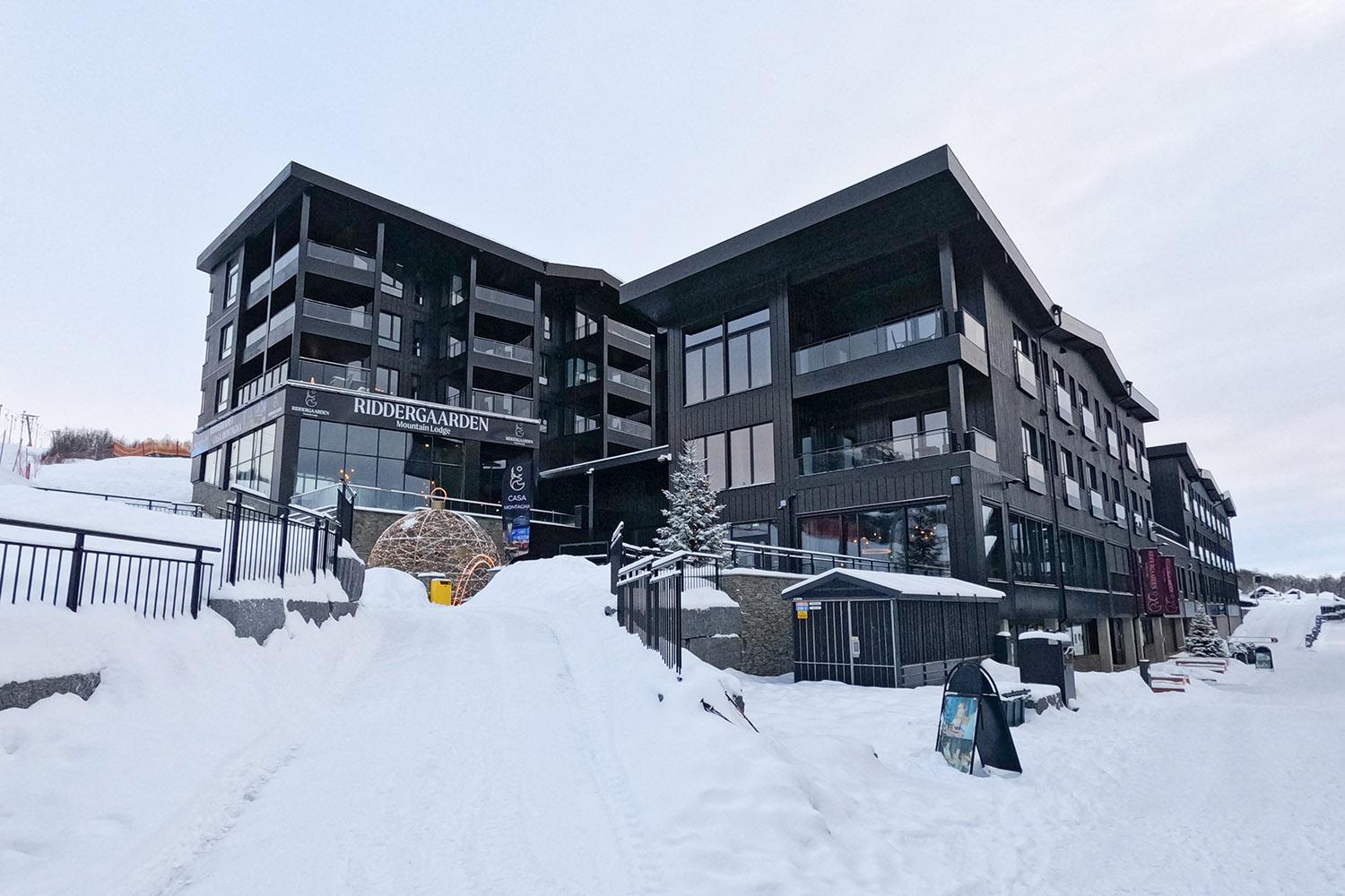
Places to stay
Find a hotel or a cabin near Beitostølen, the starting point of the scenic route in the south.
 Book nowBeitostølen
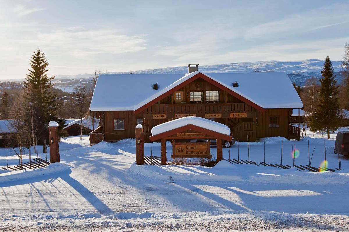
Knuts Hyttegrend
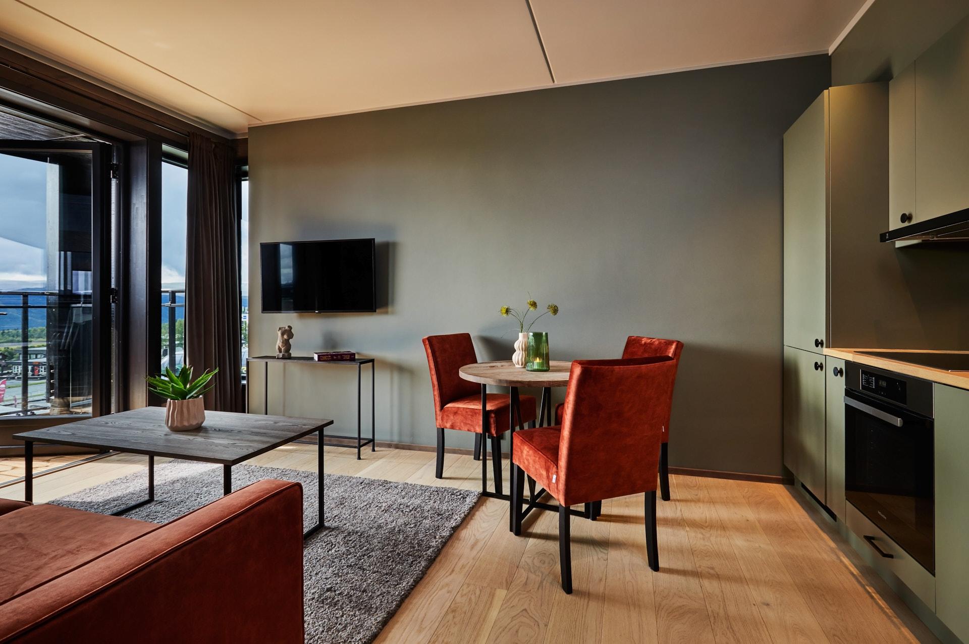
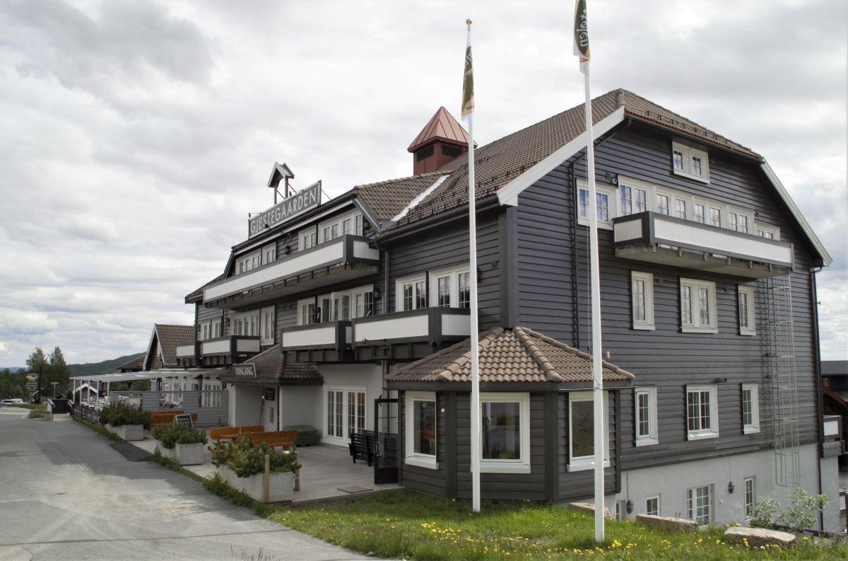
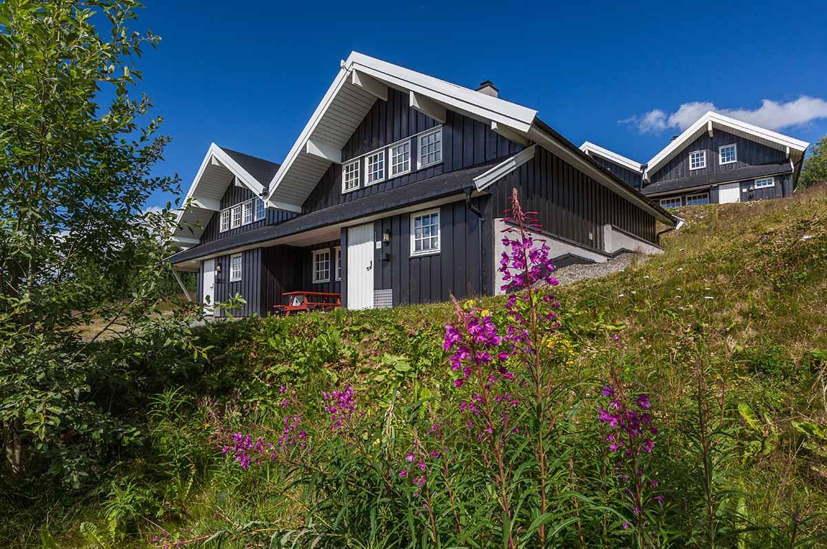
The family-run Knuts Hyttegrend is just 650 metres from the slopes of Beitostølen Ski Resort and 40 minutes' drive from Fagernes. It offers modern, spacious apartments and cottages with free Wi-Fi. All accommodation options at Knuts Hyttegrend feature private bathrooms and living rooms with a TV, CD player and fireplace. Kitchen facilities include a tea and coffee maker and refrigerator. A communal laundry room is located nearby in the main building. Relaxation options include terraces, while the large grounds offer plenty of space for kids to run around in. In summer, fishing and hiking are popular activities in the area. Downhill and cross-country skiing can be enjoyed during winter months. A supermarket is 200 metres away.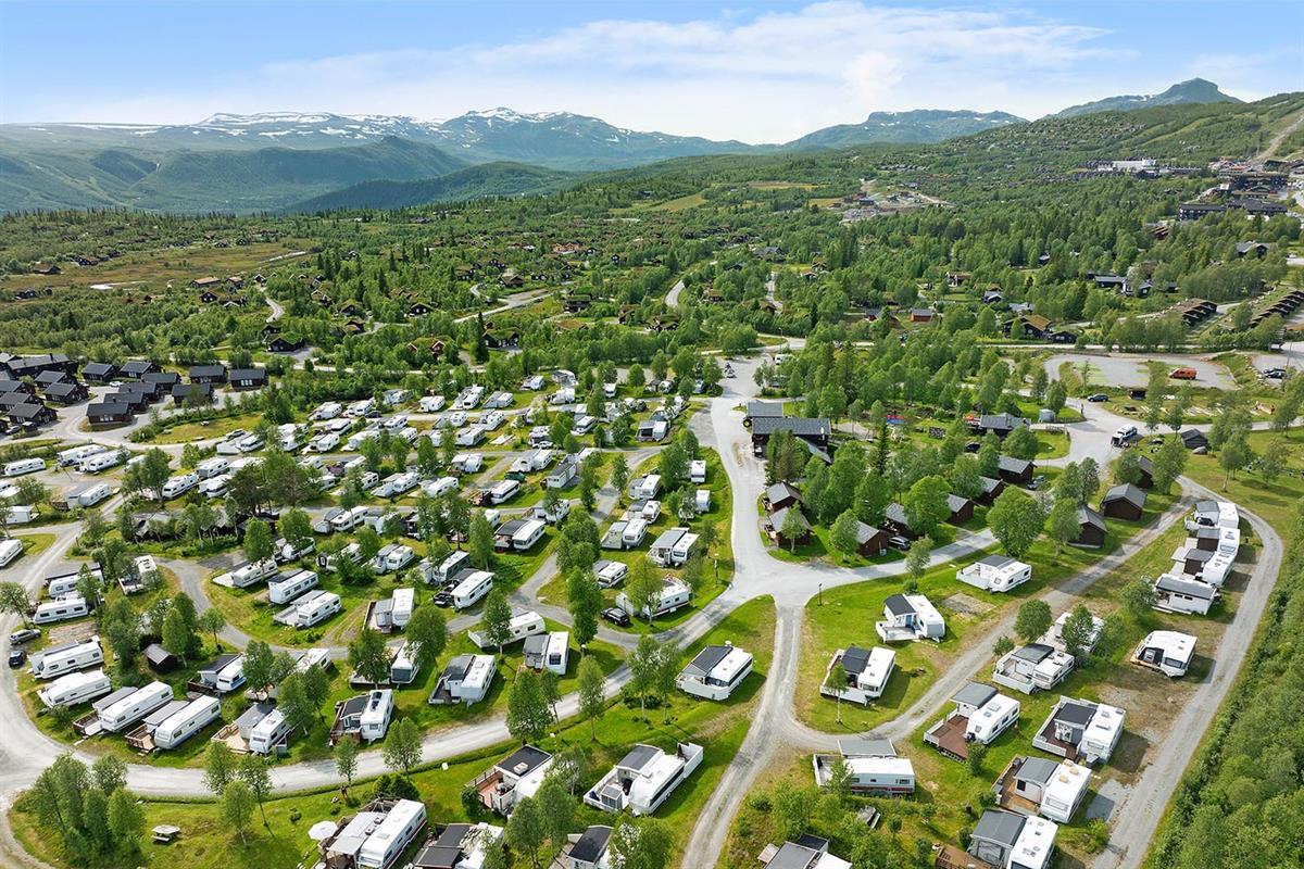 Book nowBeitostølen
First Camp Beitostølen
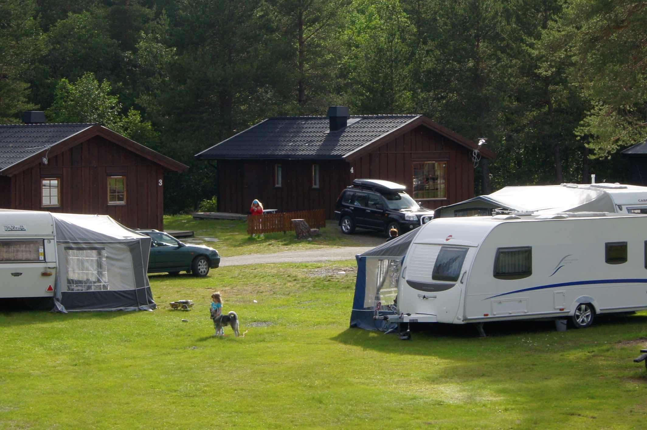
First Camp Beitostølen - Valdres A camp ground surrounded by great mountain nature and real mountain spirit. Welcome to First Camp Beitostølen in Valdres, beautifully situated in the foothills of Jotunheimen, with a short distance to the village centre. With us, you stay comfortable in well-equipped cabins or on the camp ground in a caravan, RV or tent. Everything is situated with walking distance to the facilities and service buildings, recpetion, restaurants and super market. After an ative outdoor day you can relax in the sauna or just enjoy the mountain view and quiet from the deck of your cabin. During winter Beitostølen offers hundreds of kilometers well-groomed cross-country skiing tracks and great family friendly alpine skiing hills During summer you can enjoy mountain hiking, downhill and trail cycling, a via ferrata and horse back riding. The area is the perfect base for hikes in Jotunheimen or fishing in clear mountain lakes. On our grounds we offer a play ground, minigolf and outdoor chess, perfect for lovely days together. Welcome to true mountain joy at Beitostølen, all year round.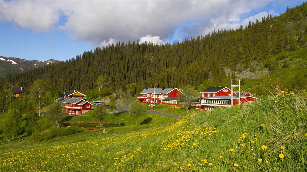 Book nowBeito
Grønolen Fjellgard
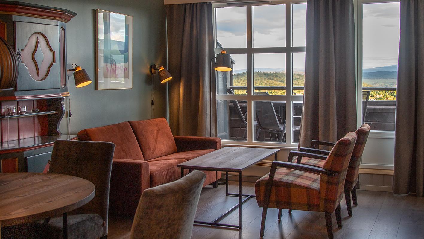
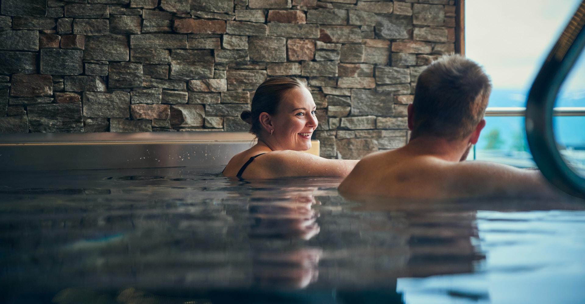
Grønolen Fjellgård is located 800 metres above sea level, surrounded by mountains and open highland landscapes. We have a wellness area with a counter-current pool, hot tub, sauna, and fitness room, and are well-known for our delicious, homemade food. In total, our Mountain Lodge sleeps 110 guests in 22 family, single and double rooms, all with private bathroom facilities. We also have 12 comfortable apartments. Grønolen Fjellgård offers a good standard, attentive service, and a rural style rooted in local traditions. The lodge is decorated with work by local artists, creating an atmosphere that is both distinctive and welcoming. Guests can expect a warm and personal hospitality. From our sheltered surroundings, guests can look out over the beautiful Lake Øyangen and experience the varied mountain landscape. Grønolen Fjellgård is located along the Mjølkevegen cycling route and is a Mjølkevegen Partner. Courses and conferences At Grønolen Fjellgård, you and your colleagues can work in a calm setting, combined with opportunities for a range of on-site activities which makes stays both focused and refreshing. In winter, cross-country ski trails start just outside the door, making it possible to head straight onto the tracks after lunch, or take a short mountain walk before dinner during summer. Grønolen Fjellgård is a pleasant venue with a good standard and a recently upgraded and expanded meeting room accommodating up to 45 participants. Our experience is that groups benefit from having the entire lodge to themselves, which contributes to both strong professional outcomes and a cohesive stay. Book nowBeitostølen
Hovi Hytter
12 semi-detached traditional cabins, 50sq.m, situated close to the centre of Beitostølen. The cabins sleep six people, one double bedroom and one with two bunk beds. The cabins have a living area with cable TV, fully equipped kitchen area with a breakfast table and an outdoor patio. Booking and check-in at Beito Resort Hotel
Activities near Beitostølen
Use the area as a base for more adventures!
 Book nowBeitostølen
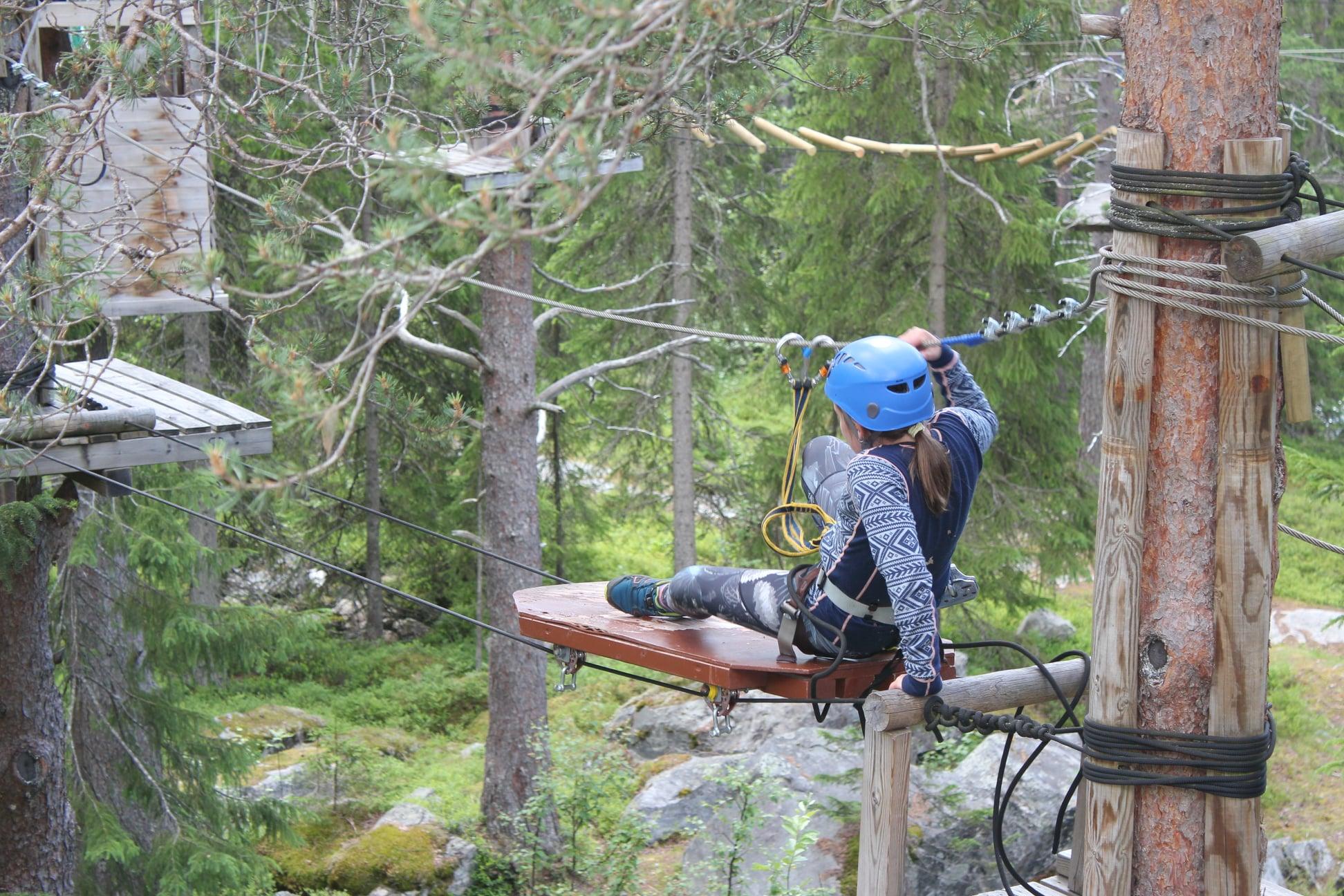
Beito's High Rope Course
Beito High Ropes Course is located in scenic surroundings in the Beito forest, a few kilometres from Beitostølen. There are three different trails marked green, red and black. The black trail is the most challenging of the three trails. The park is located on private property and need to be prebooked. The park is open during spring, summer and autumn. User must be at least 10 years of age and have a minimum height of 130 cm. The maximum weight is 100 kg. We also have a climbing park for the youngest children from 4 years old and 105cm, max 30 kg. Please read more about that here. On rainy days a waterproof jacket is highly recommended. During thunderstorms, the park can be closed on short notice until the weather passes. Click here for more information.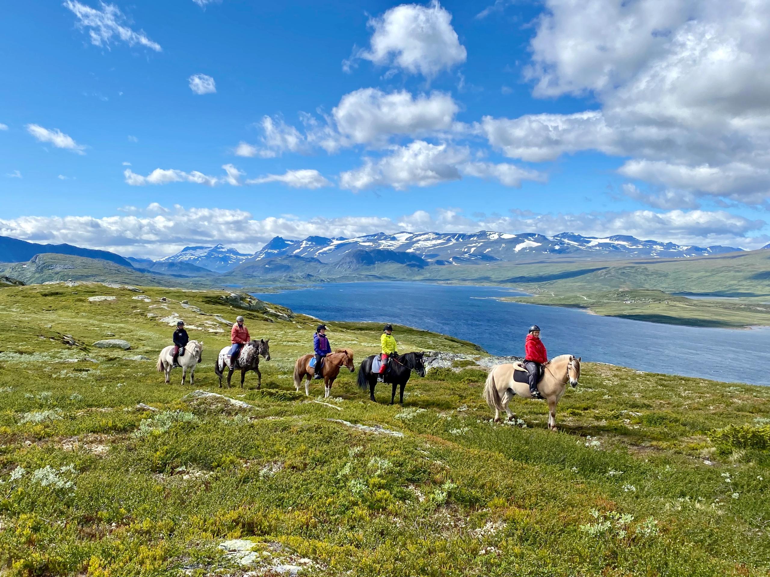 Book nowSkammestein
Myhre Gård
Myhre Gård offers horseback riding trips and farm visits in fantastic mountain scenery close to Beitostølen. Open all year. Horseback riding At the riding centre you can sign up for various classes, horseback riding for people with disabilities, and you can request tailor-made riding activities for larger groups. The length and difficulty can be adjusted to the client's wishes. We ride mostly in the scenic mountain landscape around Beitostølen and in the Langsua National Park. During the school holidays we arrange horseback riding camps for children and youths. During summer you can join us on overnight trips into the mountains to our summer mountain farm. Myhre Gård is a member of the association "Hest i turistnæring" ("Horses in tourism"), which cares for quality and safety. Farm holidays There are other animals at the riding centre, and you can spend a farm holiday at Myhre Gård. Join us with daily chores and caretaking of the various animals, collect your own eggs in the hen's inclosure for breakfast, experience the births of lambs in spring and join us on horseback riding trips to the summer farm to have a cozy lunch around a bonfire. Please visit our homepage for more information about the different horseback riding trips and other activities.
If you continue on the county road, you'll reach the starting point of the scenic route.
Just look at that view!
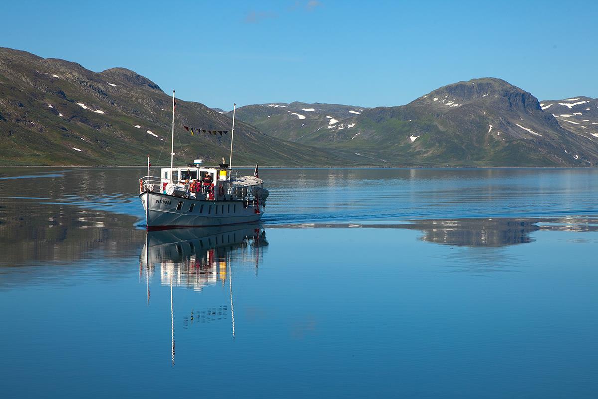
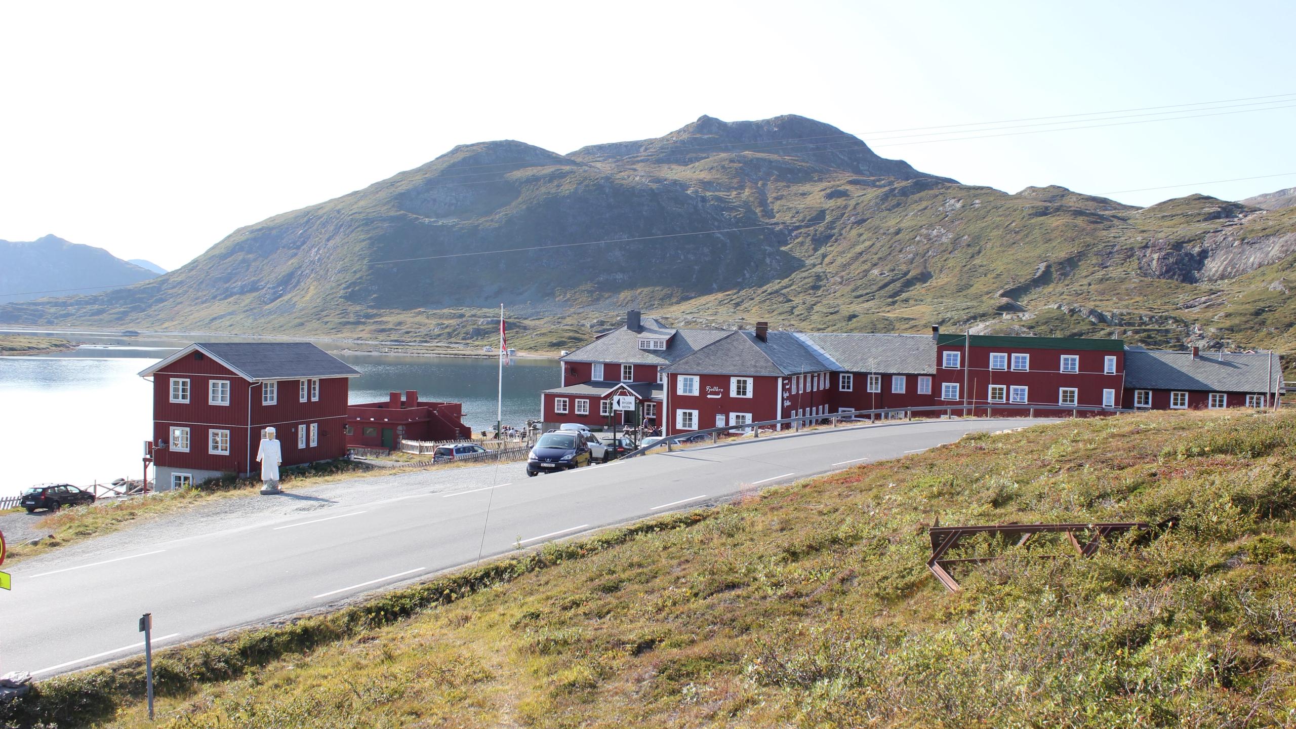
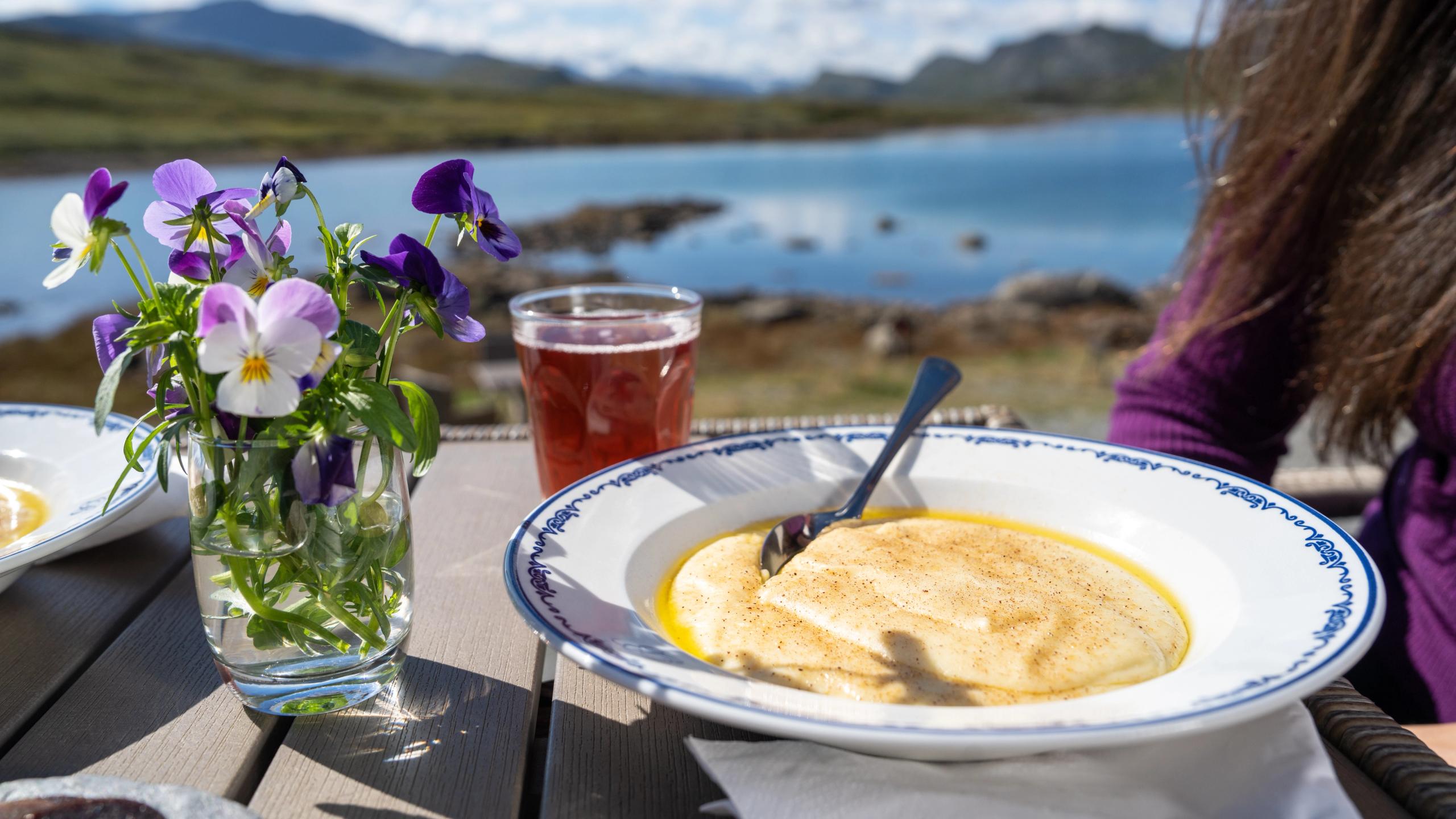
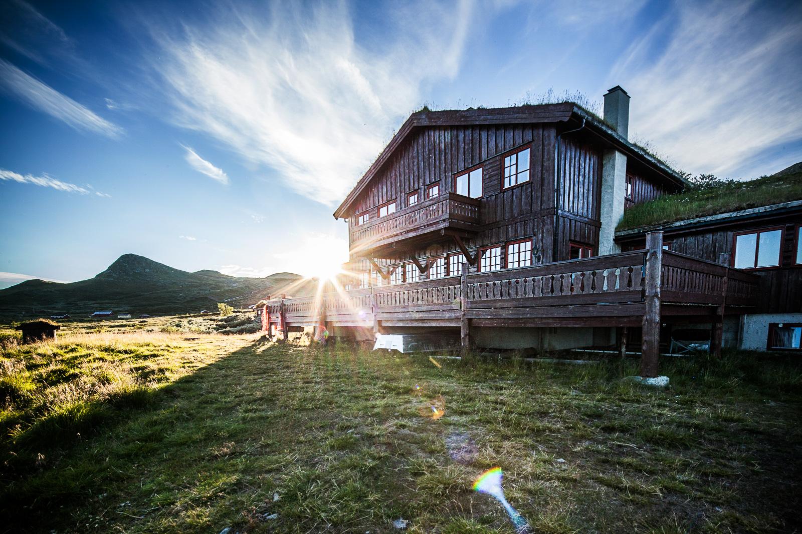
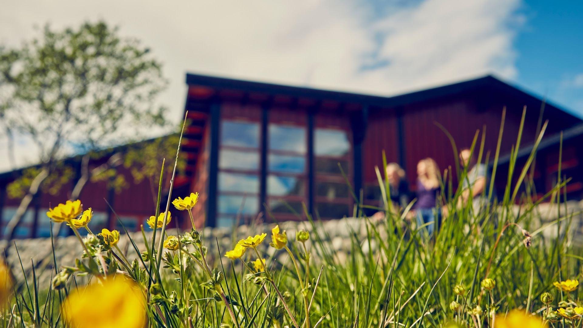
At the foot of the Jotunheimen mountain range, approx. 12 kilometres from Beitostølen, lies the historic Bygdin Høifieldshotel, with roots going back to 1897.
All year round, the hotel café serves waffles, and in summer, you can sample its traditional sour cream porridge with cured meat – a must-try in the mountains!
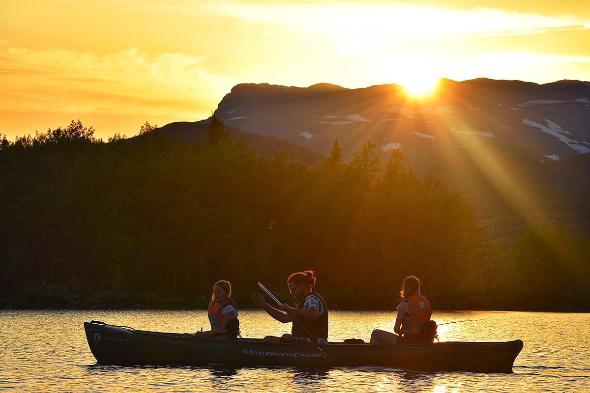
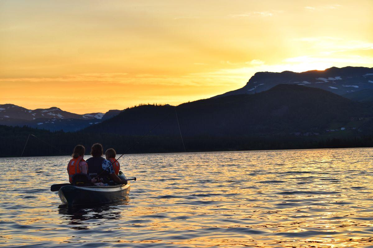
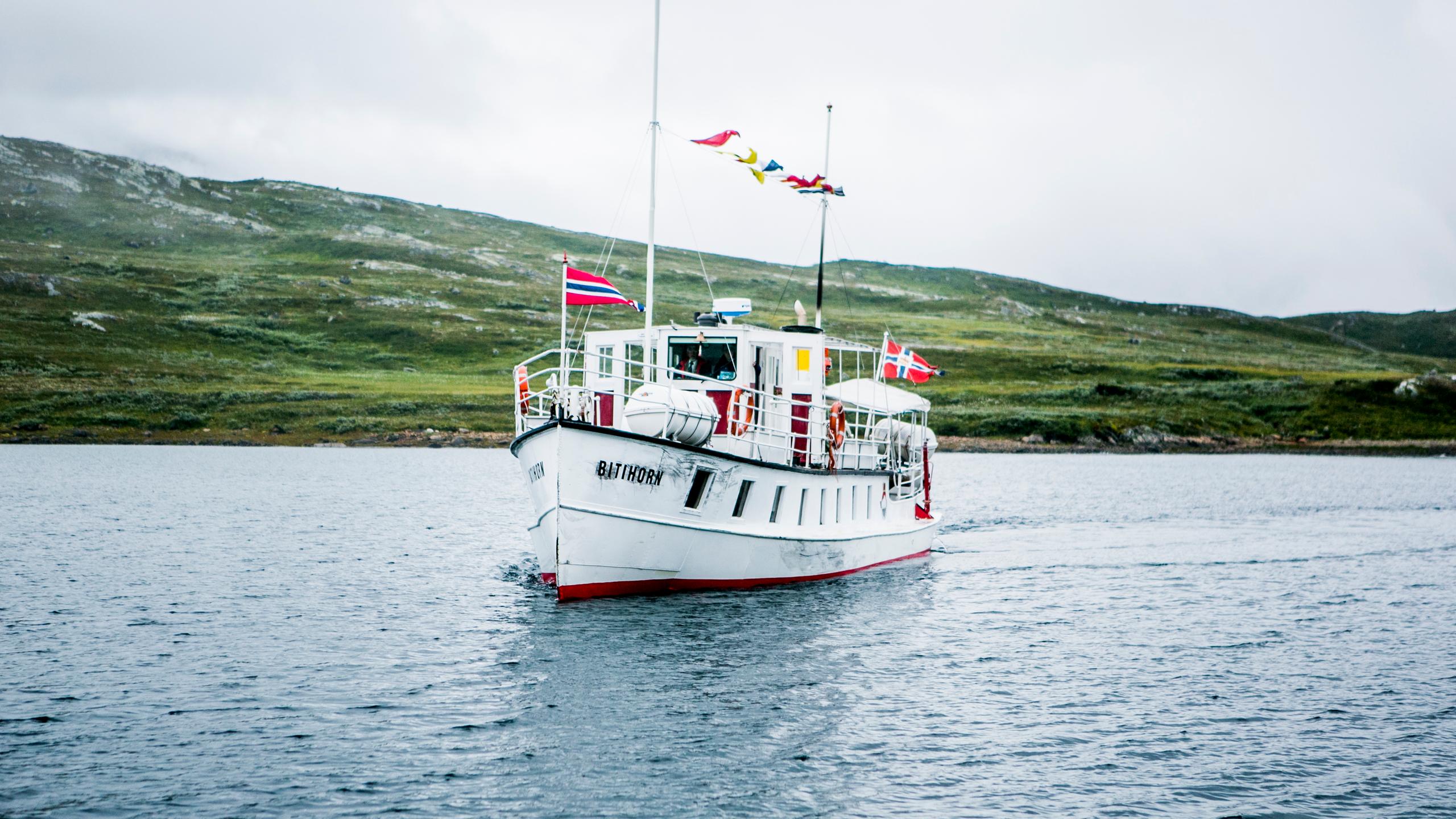
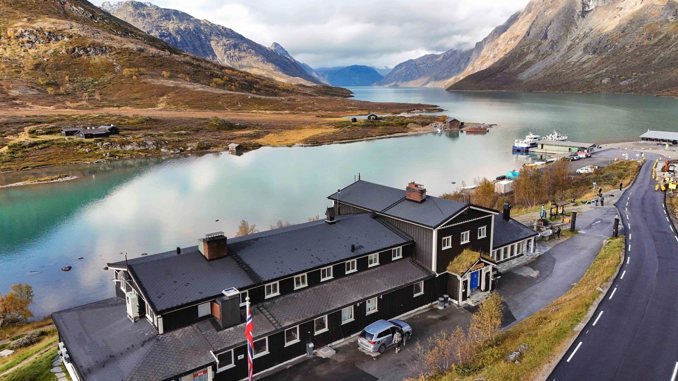
From here, you can also experience one of Northern Europe's highest boat trips. M/S Bitihorn takes you on a journey along Lake Bygdin with a view to some of the 2,000 peaks in the area.
The boats call at Bygdin, Torfinnsbu, and Eidsbugarden – all great starting points for hikes!
More activities near Bygdin
This area is a paradise for outdoor activities.
 Book nowBeito
Synshorn Via Ferrata
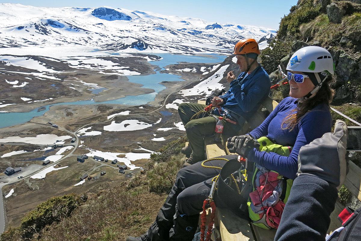
Synshorn Via Ferrata The Synshorn Mountain is situated between the lakes Bygdin and Vinstre. Experienced guides take you safely up the steep rock face at the front of the mountain. The view is simply breathtaking. There are a couple of resting areas (bench/cliff gallery) on the way. The name Via ferrata originates in Italy, where iron paths were constructed in the Dolomites under the First Word War to improve the accessibility of the mountains for the troops. The modern Via ferrata is a climbing path with iron steps and wires in steep rock faces. You don't need any former climbing experience, but you should be in reasonably good physical shape. Minimum age 12 years. For more information and booking, visit www.synshorn.no Book nowBeitostølen
Guided tours with Jotunheimen Mountaineering
At Jotunheimen Mountaineering, we offer guided mountain tours all year. Our range of activity is mainly concentrated in the area around Beitostølen and the "Gjende Alps"; the part of Jotunheimen that is located between the Bygdin and Gjende lakes. We also arrange tours in other parts of Jotunheimen upon request. During winter, in addition to ski touring, we set up courses in off-piste skiing and avalanche rescue, with emphasis on safety on mountain tours. Visit us on facebook for an overview of our scheduled tours. Book nowBeitostølen
Guided kayak tours on Lake Bygdin
We offer fantastic kayaking tours on the mountain lake Bygdin. Join us on a half day-tour with information about local history or a full day trip to Torfinnsbu. There are different packages to choose from, some of which also combine kayking and alpine mountain ascends. Read more on www.bygdin.com/aktiviteter (in Norwegian) and contact us for information and offers!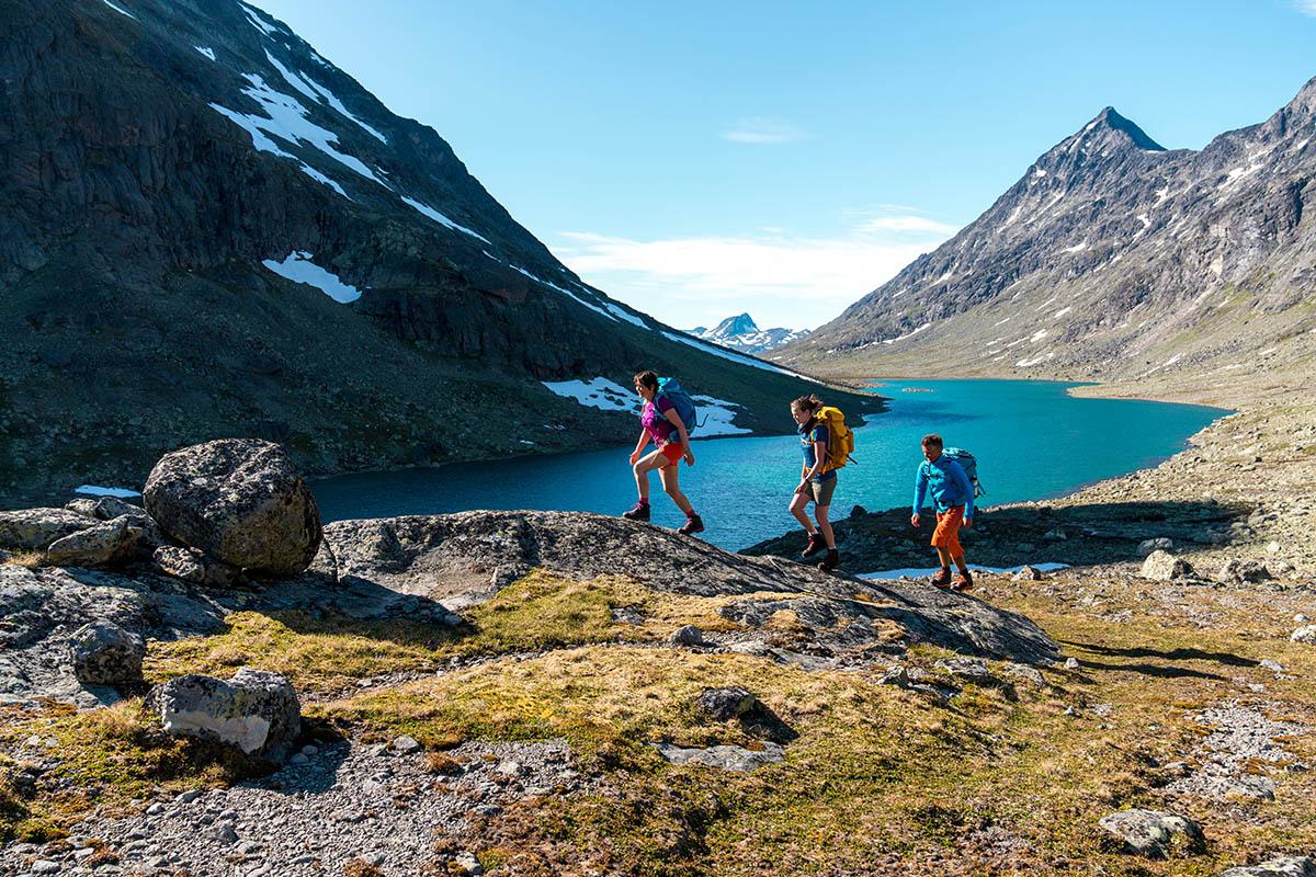 Book nowBeitostølen
Discover Jotunheimen - The Green Route
Self-guided hiking package in Jotunheimen. The Green Route is suitable for hikers with average experience and condition. Along the route you will visit some of the most renowned, historical accommodations in Jotunheimen. When booking this tour package with Jotunheimen Travel, accommodation, meals and baggage transport are included. All your need to do is carry a day pack with essential gear and get out and experience the breathtaking mountain scenery yourself. Itinerary: Day 1: Arrival at Bygdin Day 2: Day hike to the summit of the mountain Bitihorn Day 3: Boat Bygdin-Torfinnsbu and hike through the Svartdalen Valley to Gjendebu Day 4: Free day at your disposal at Gjendebu Day 5: Hike from Gjendebu to Eidsbugarden Day 6: Departure from Eidsbugarden. For more information and booking, visit the homepage of Jotunheimen Travel- Book nowBeitostølen
Besseggen and Svartdalen Valley - Hiking package
Try our Jotunheimen highlight combo hike with two of the best hikes in Norway, Svartdalen and Besseggen. All meals and transportation is included. The tour includes transportation between the hikes and Bygdin, as well as the tickets for the three boat trips needed for this excursion. You can also add transfer to and from Oslo, making this a complete roundtrip from the Norwegian capital. For this excursion/trip we offer our Jotunheimen Travel “Hiking-Board” meal plan with 3 meals a day included in the price! Around 60 000 people hike over the popular and spectacular Besseggen ridge every year. Join and find out why! Close by is one of the lesser known, but just as beautiful valleys, Svartdalen. This is a great opportunity to do both in two days. We will arrange all the details, and you only need tie your hiking shoes and enjoy the hike! More information on Svartdalen More information on Besseggen Accommodation Bygdin Høifieldshotel: For this package you will be offered a double room with a private bath at Bygdin Høifieldshotel. Bygdin Høifieldshotell try to keep the old style and atmosphere. Furnitures and other equipment around the building can be traces back through history and gives the building its soul. The hotel also offers space for mountain boots, ski shoes, bikes and of course space for your dogs.
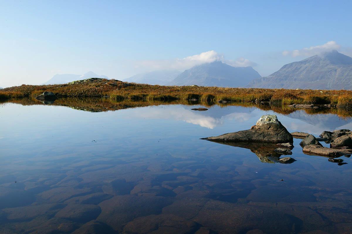
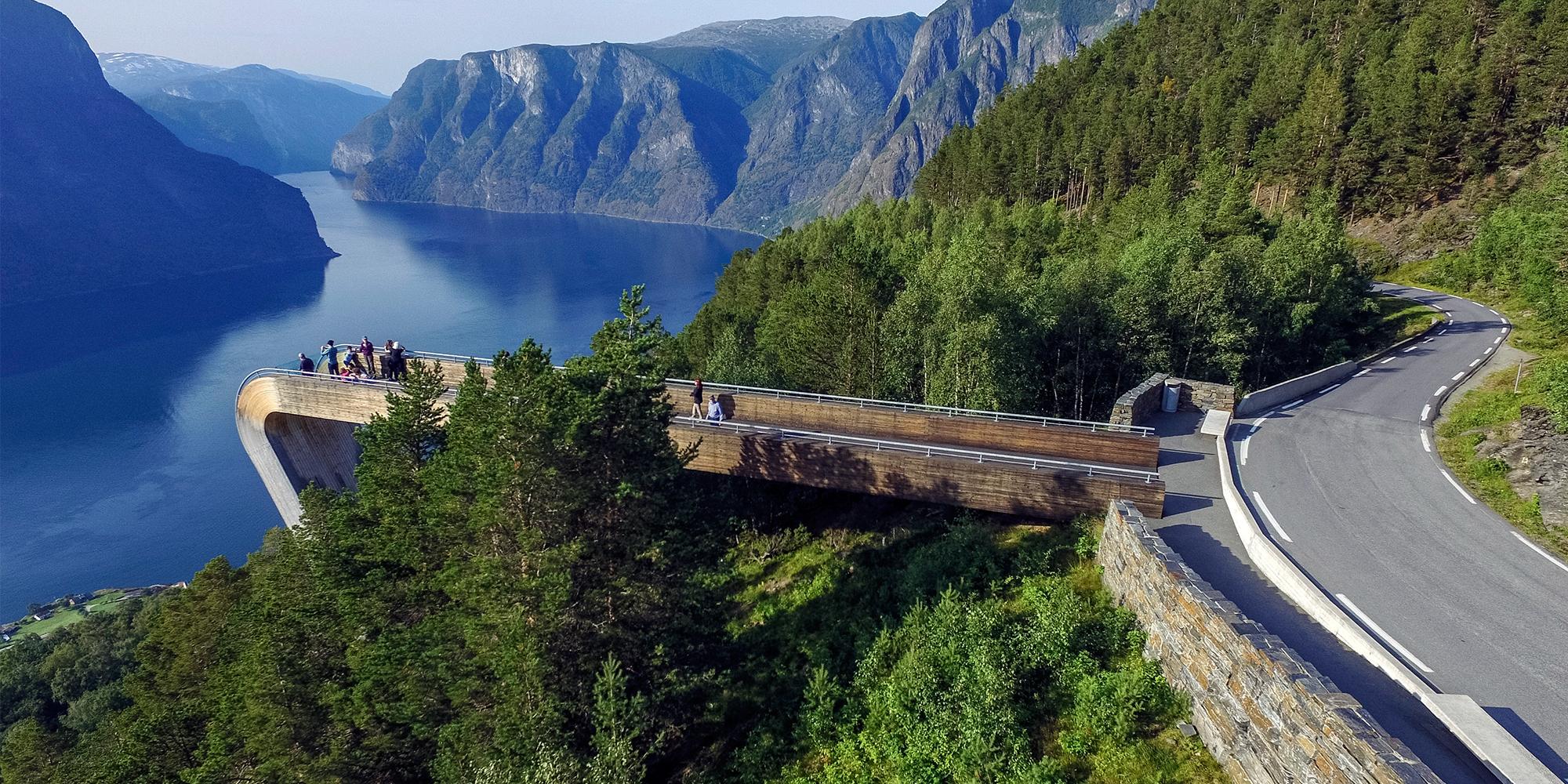
Take your time and stop by the viewpoints along the route.
The rest area at Rjupa provides a panoramic view of traditional mountain hamlets and the Valdres valley.
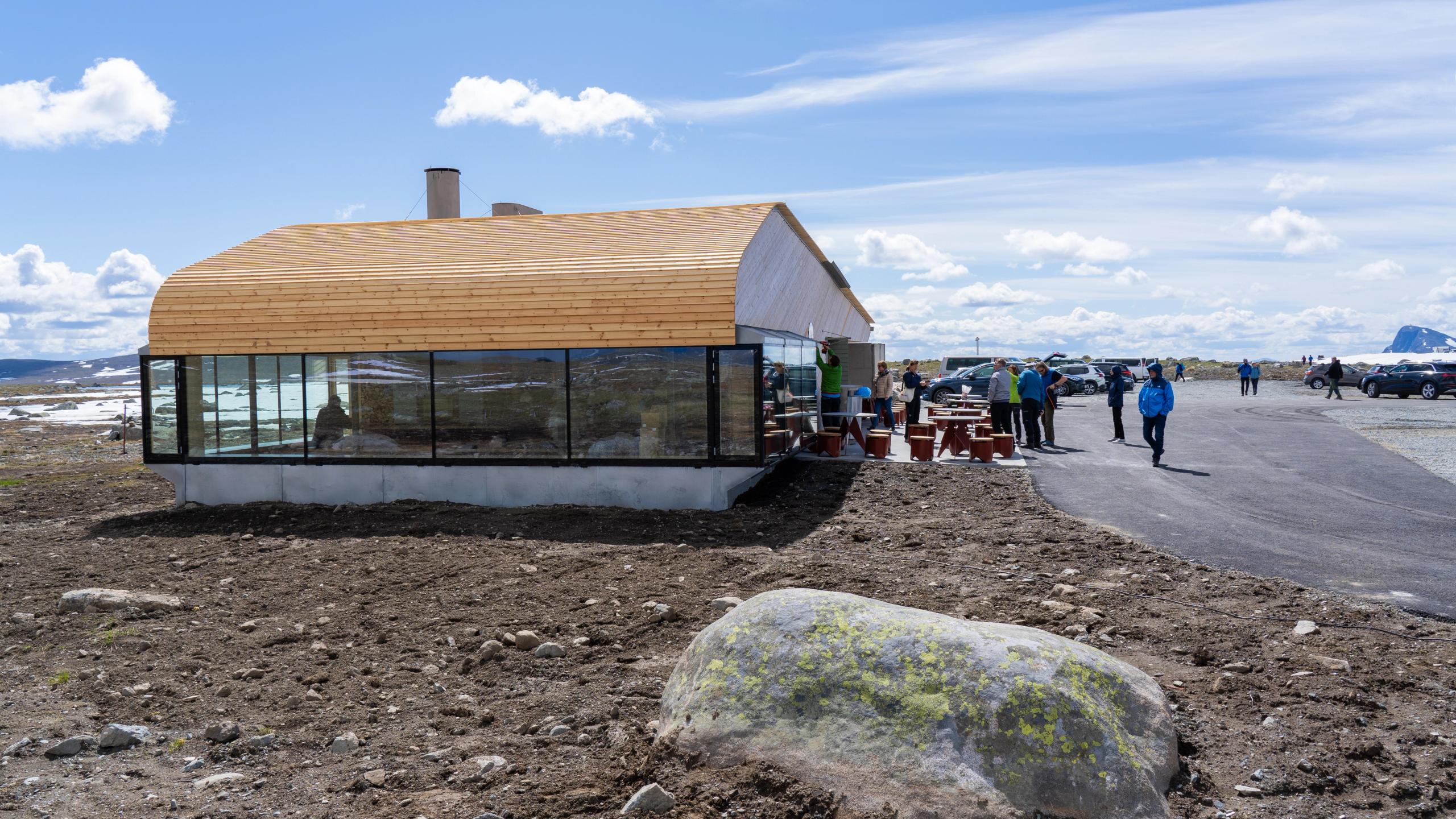
When the road reaches its highest point at 1,389 metres above sea level, you'll arrive at the Valdresflye Kafé where you can stop by for some local food.
On a clear day, you can see mountain peaks such as Besshøe, Høgdebrotet, Tjønnholstinden and Rasletinden from the café.
From here, you can also hike back to Bygdin. In summer, you can take the bus from Fagernes or Beitostølen to the starting point at the café.
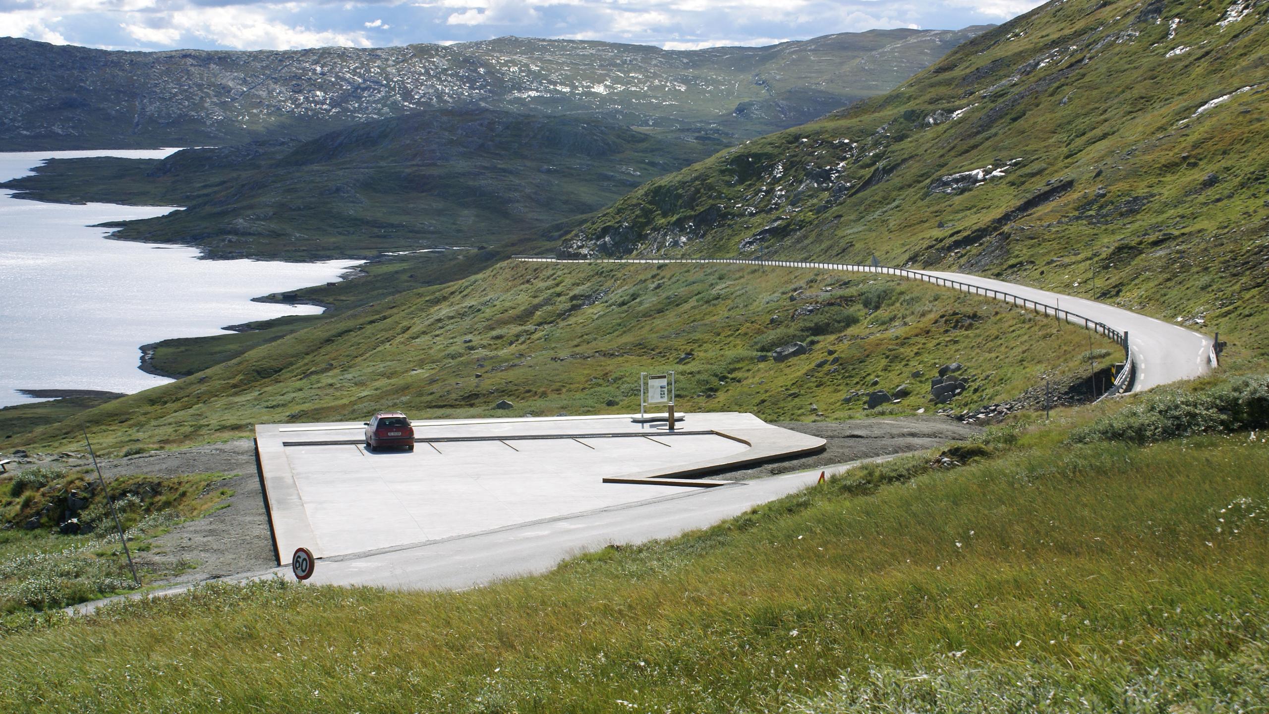
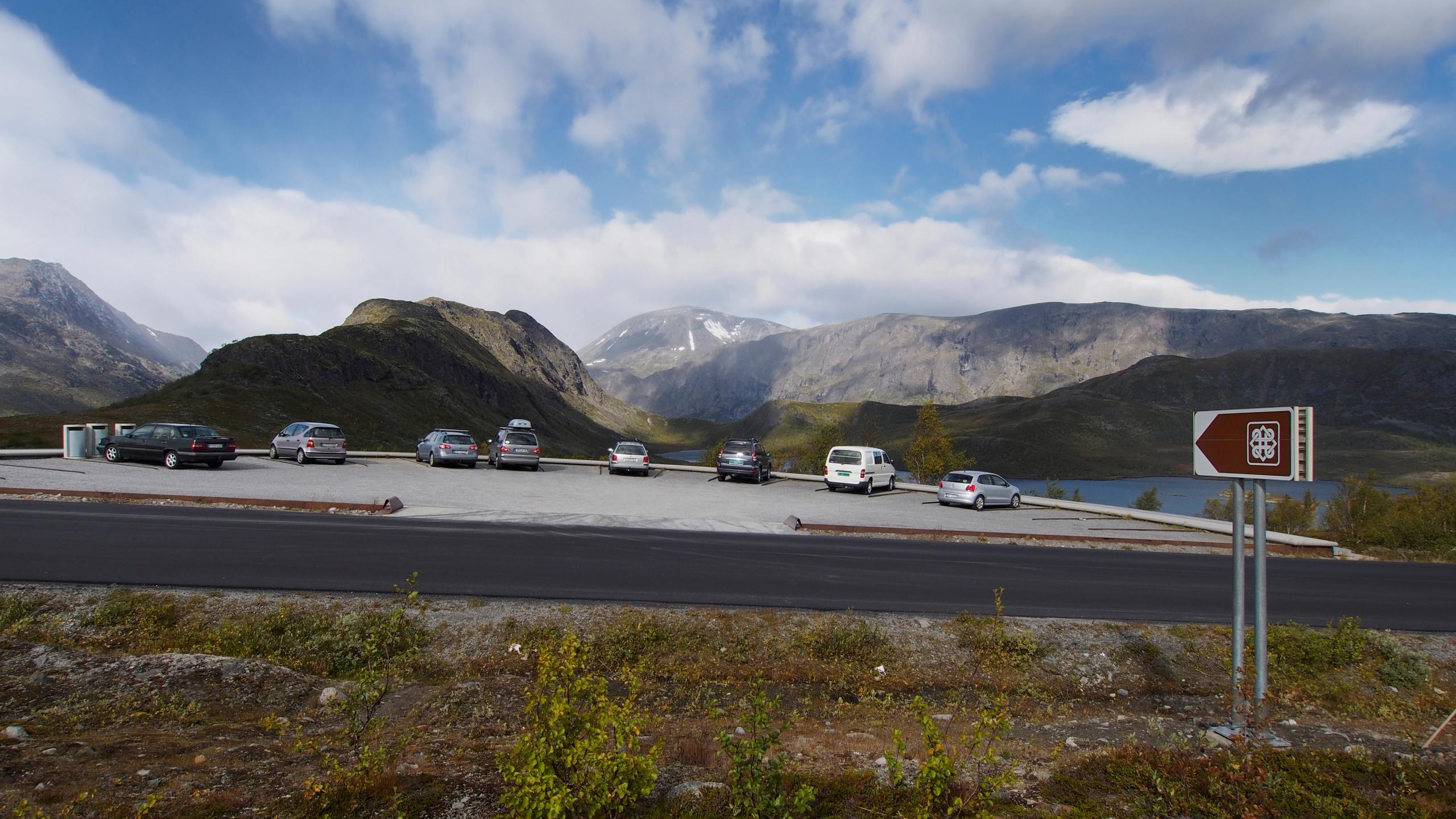
As the road wind its way through the mountain plateau, you'll reach Vargebakkane – a small car park and a popular view point.
Not too far ahead, one of the main attractions in the area awaits.
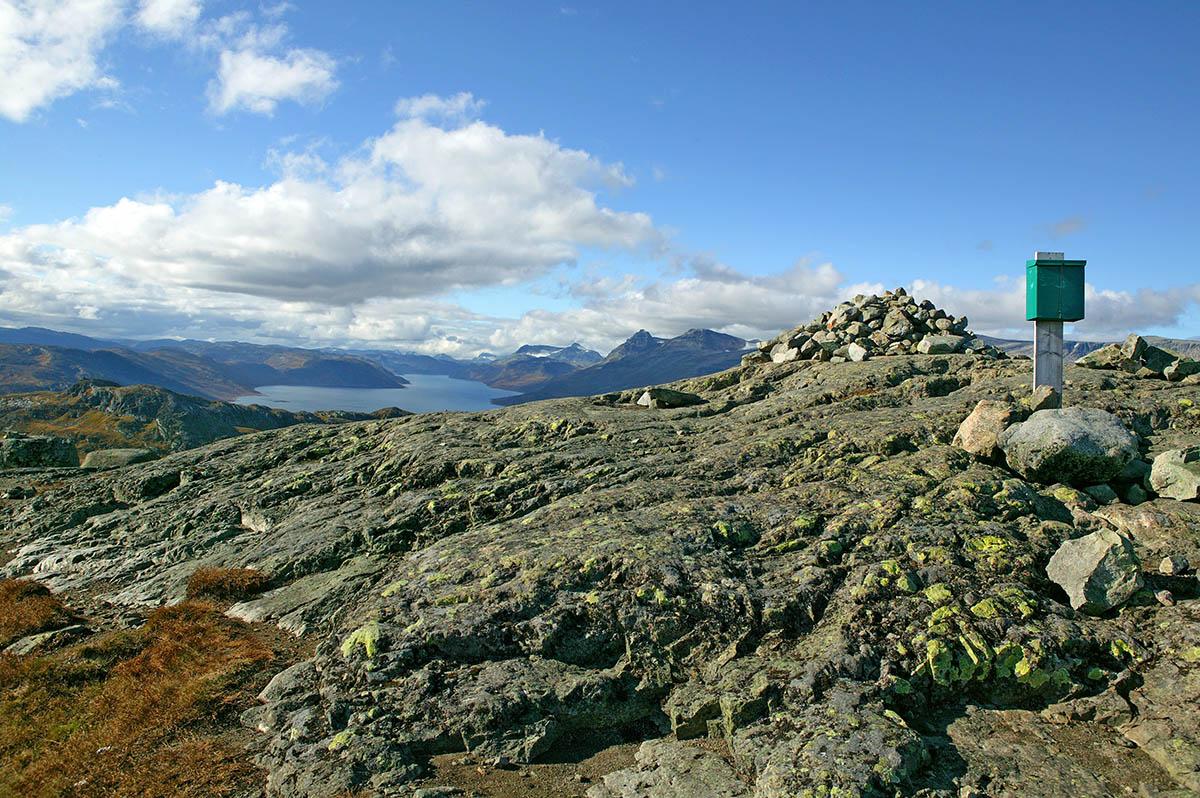
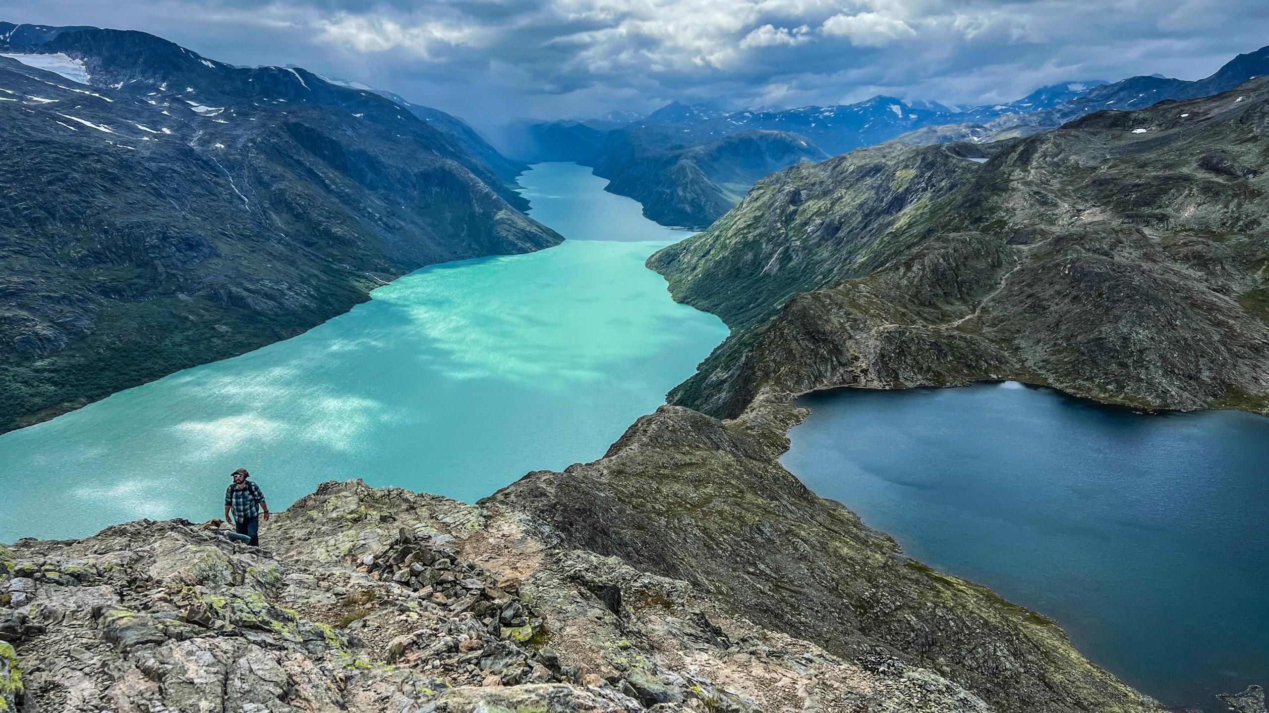
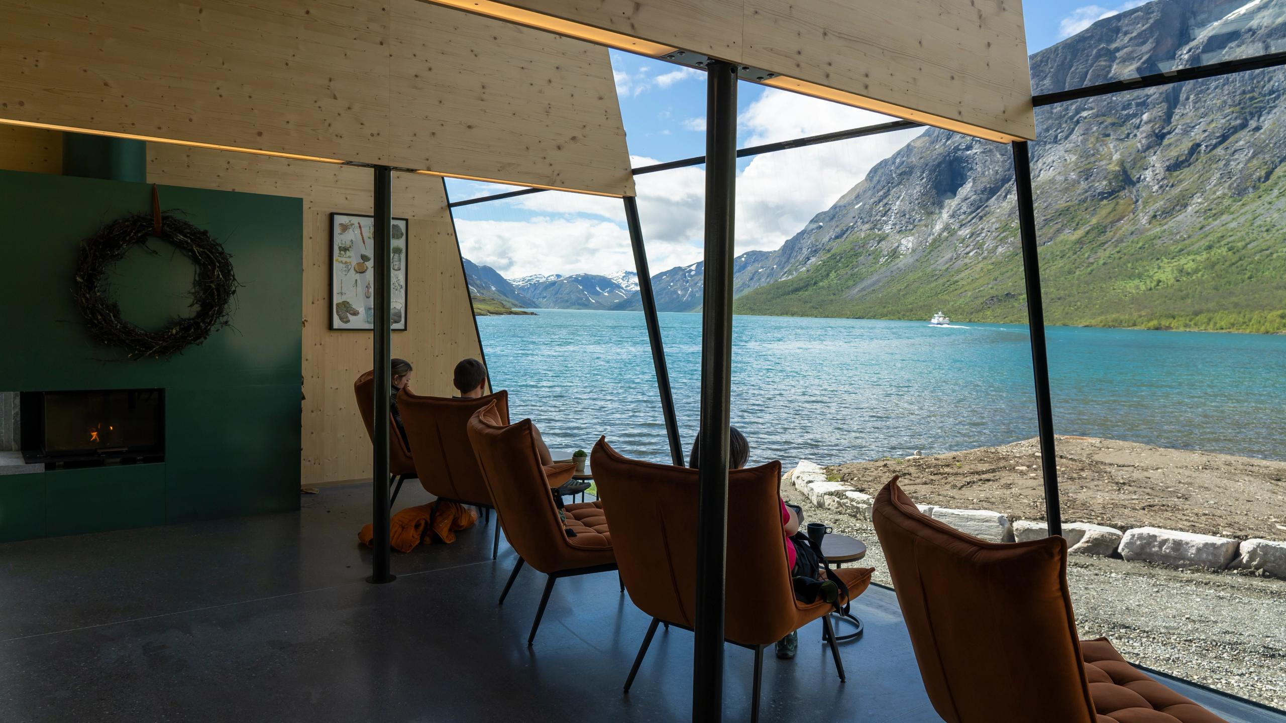
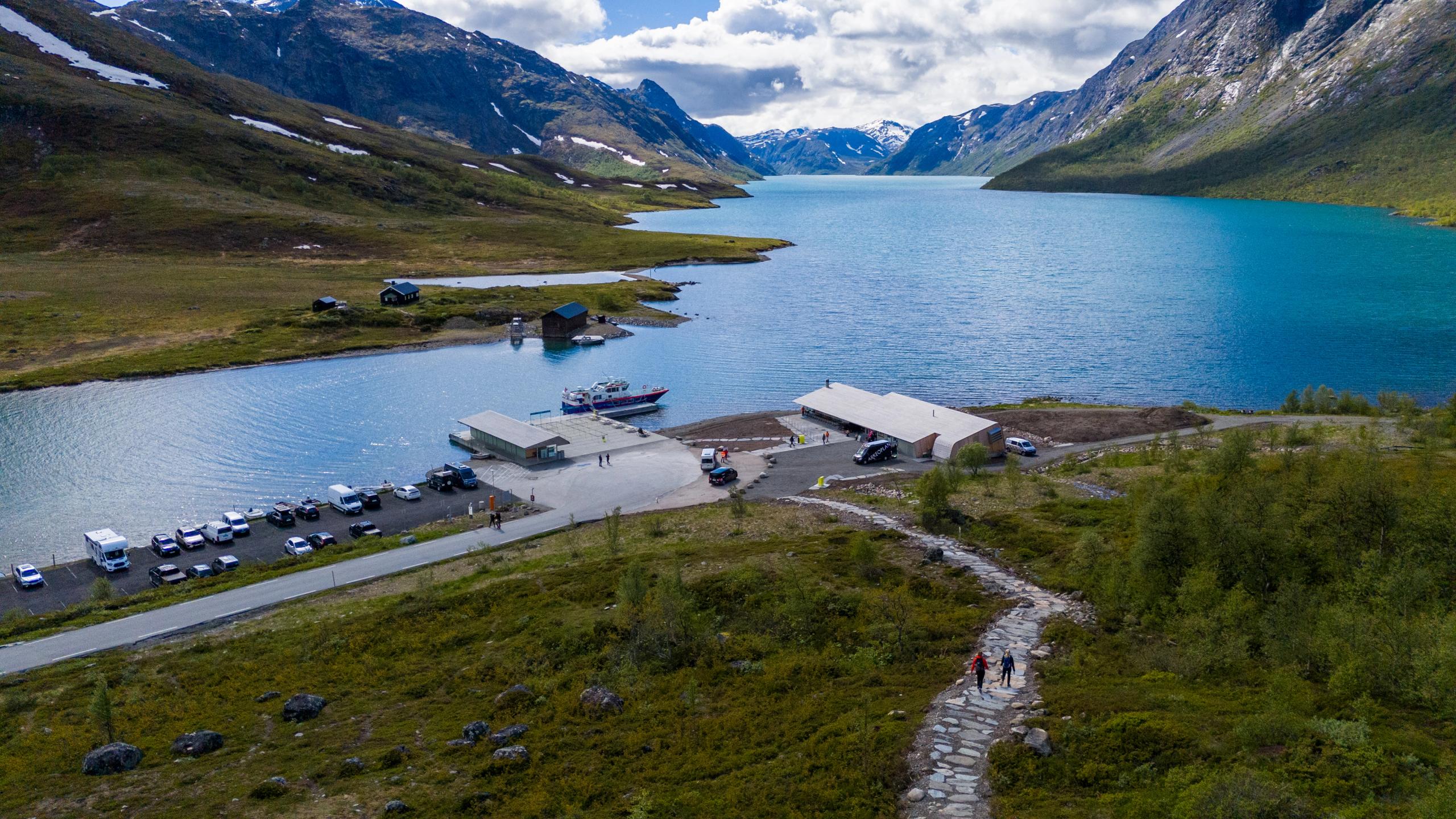
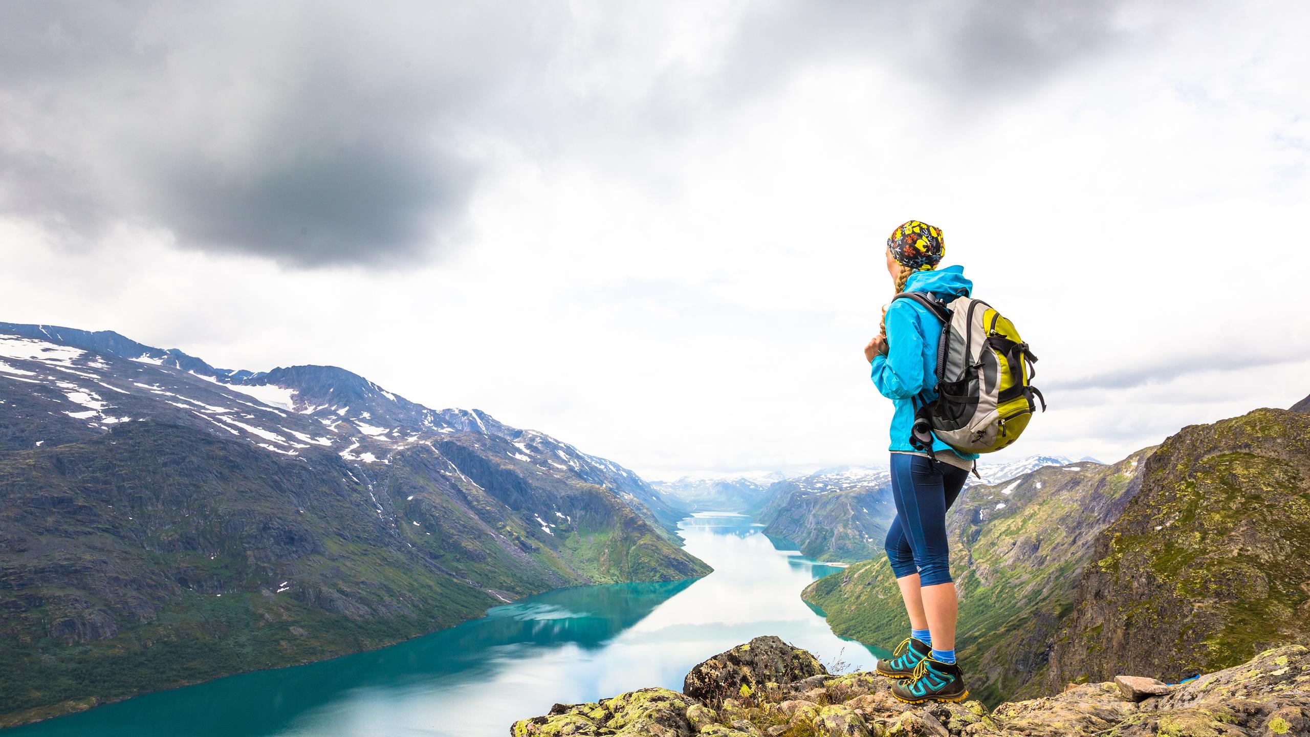
Gjendeosen is a meeting point at the gateway to Jotunheimen National Park. Here, you'll find beautiful lake Gjende, famous for its bright turquoise water.
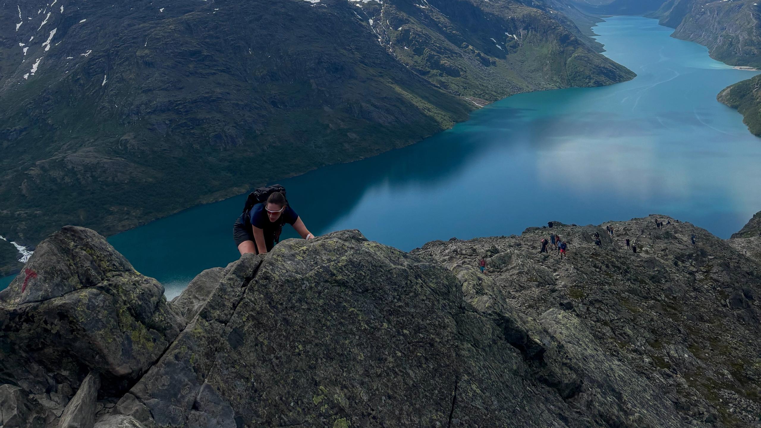
And, of course, the starting point of the hike along Besseggen.
Right by the Gjendeosen café, you can take a boat to Memurubu. From here, you can walk the ridge back to the starting point by the café. It's also possible to hike the other way, but do make sure your plans correspond with the ferry departures.
In peak season in summer, it's recommended to book tickets for the ferry in advance.
Note that parts of the trail are steep, and involve some scrambling. You can expect to spend between 7–8 hours to complete the hike, so it's not for everyone!
Always make sure to have proper hiking gear, water, and supplies needed to stay safe in the mountains. Always tell someone where you are going and when you plan to be back.
More hikes nearby
Explore the mountains and valleys of Jotunheimen! And remember that there are plenty of fantastic guided tours as well.
 Book nowTessanden
The Historical Hiking Route in Jotunheimen
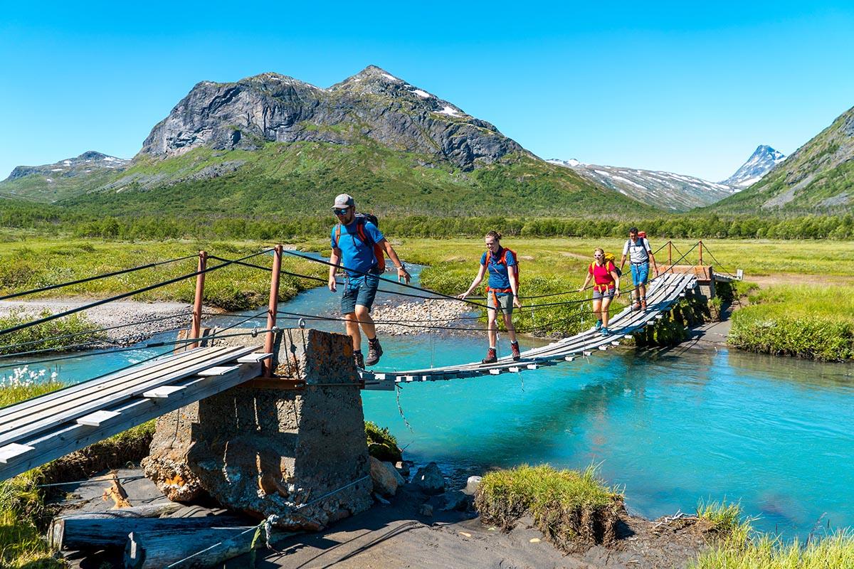
The Historical Hiking Route Jotunheimen leads through one of the most beautiful parts of Jotunheimen. It follows the historical path that the explorers of the mountain area took during the 19th century. This package tour is with a trained and knowledgeable guide who knows the local history and stories behind the route, and will take you safely through this breathtaking mountain landscape. Tour itinerary: Day 1: Arrival Gjendesheim Day 2: from Gjendesheim to Memurubu over the Besseggen ridge Day 3: from Memurubu to Gjendebu via Bukkelægret Day 4: Day at free disposal at Gjendebu Day 5: from Gjendebu to Torfinnsbu through the Svartdalen Valley Day 6: from Torfinnsbu to Eidsbugarden Day 7: Departure Learn more about this trip and book on the homepage of Jotunheimen Travel.
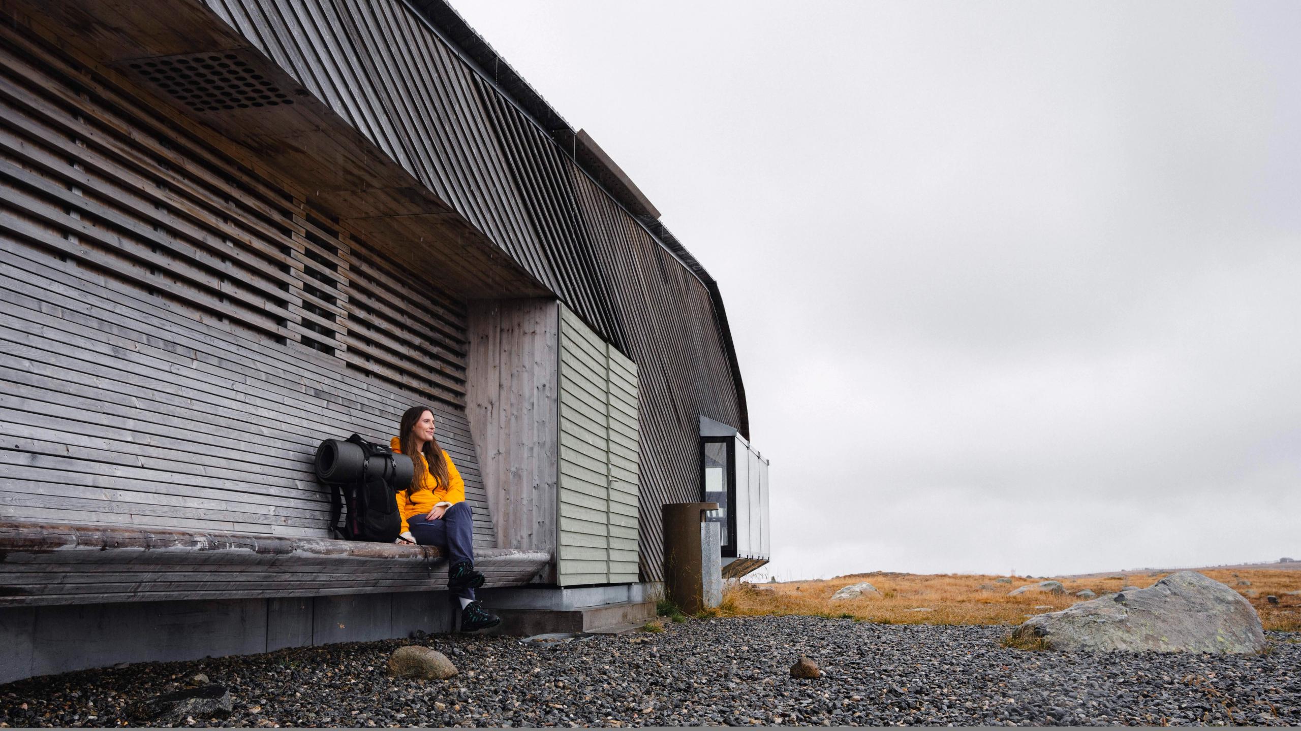
Stay in a traditional mountain lodge
Get the most out of your trip in the mountains with a stay in a traditional mountain lodge, called fjellstue in Norwegian!
Many mountain lodges also serve hot and comforting food made with local ingredients, perfect as fuel before or after your hike.
Right by Besseggen, you'll find the popular mountain lodge Gjendesheim, run by Norwegian Trekking Association. It even has its own 'food manifesto', which ensures that guests will not only have a tasty meal, but a sustainable one as well.
"There's a lot of focus on eating less meat, but I think it's just as important to encourage people to eat everything on their plate to prevent food waste, and to communicate why local products are important," says host Marius Haugaløkken.
Free-range pigs from Sveen Gard, lambs that have been grazing in the mountains from Snerle Gard, and potatoes harvested at Sve Gard in Vågå are just some of the local produce used in the kitchen at Gjendesheim – good for you as well as for the local farmers.
Mountain food
Another great mountain lodge in area is Bessheim, located right by county road 51. Here, they have been welcoming guests since 1890. On the menu, you will find the best produce from the area, including mountain trout, moose, deer, and lamb.
A speciality you have to try while in the area is reindeer meat, which, according to head chef Bjørn Ekkerbakke, tastes just like the mountains.
"It has this incredible wild flavour and tender meat," says Bjørn, adding that they get all their meat from Vågå Tamrein, a local association that has been active in Jotunheimen since 1942.
The historic hotel Hindsæter is also worth a stay, situated right above the Valdresflye Scenic Route. The hotel offers mountain luxury and tasty local food with views over the river Sjoa and Jotunheimen.
Accommodation near Valdresflye
Have a tasty and cosy trip in the mountains with a stay in a traditional mountain lodge or go camping!
 Book nowBeitostølen
Haugseter Mountain Lodge
Haugseter Fjellstue is a traditional mountain lodge with 140 years of history in the high mountains. It is located along Jotunheimvegen, a mountain road that runs through a landscape of old summer farms and pasture cabins. At Haugseter, guests can enjoy a calm and welcoming atmosphere indoors, with homemade food and drinks, often by the fireplace. The surrounding area offers a wide range of outdoor activities, including hiking, cycling, horseback riding, and skiing. The landscape varies from high peaks with wide views to gentle terrain with old livestock paths, providing opportunities in all directions. This is one of the few areas where traditional summer farming is still active, and fishing is available both in Lake Vinstervann and in several other lakes nearby. Dining The food at Haugseter is well regarded in the area. We serve everything from traditional stølslapper (Norwegian pancakes) with jam to homemade, traditional meals and larger set dinners, often based on game, fish from Lake Vinstre, and other local ingredients. We welcome groups, meetings, and smaller conferences. If you are looking for a scenic setting and a warm, informal atmosphere for your gathering, we are happy to tailor the event to your needs. Menus and wine pairings can be suggested on request. Haugseter Fjellstue is fully licensed. Hunting A tailor-made offering for private groups, combining hunting experiences, professional guidance, and good food. Only a limited number of packages are available each year. Cycling Haugseter is located along the Mjølkevegen cycling route and is a Mjølkevegen Partner. The route offers varied terrain and breathtaking scenic surroundings. Fishing Haugseter is well suited for mountain fishing trips. Lake Vinstervann is known for its trout, used in traditional rakfisk production. Fishing permits and boat rental are available, and a small selection of fishing equipment is sold on site. Hiking Several hiking routes start directly from Haugseter Fjellstue, whether you are hiking between cabins, staying at the lodge, or heading out for a shorter day trip. Langsua National Park is located nearby. We offer: Accommodation in cabins and apartments Homemade food with a focus on local ingredients Boat rental Fishing permits and maps Free loan of fishing rods for children Private and corporate events Free Wi-Fi Winter Haugseter Fjellstue is closed during the winter season, but cabins can be rented, and snowmobile transport can be arranged. With sufficient advance bookings, the lodge opens during the Easter holidays. Please contact us for more information. Marked back country ski routes run from Haugseter toward both Langsua and Jotunheimen National Parks from mid-February until Easter. Welcome!
Enjoy the final stretch of the scenic route down to Hindsæter.
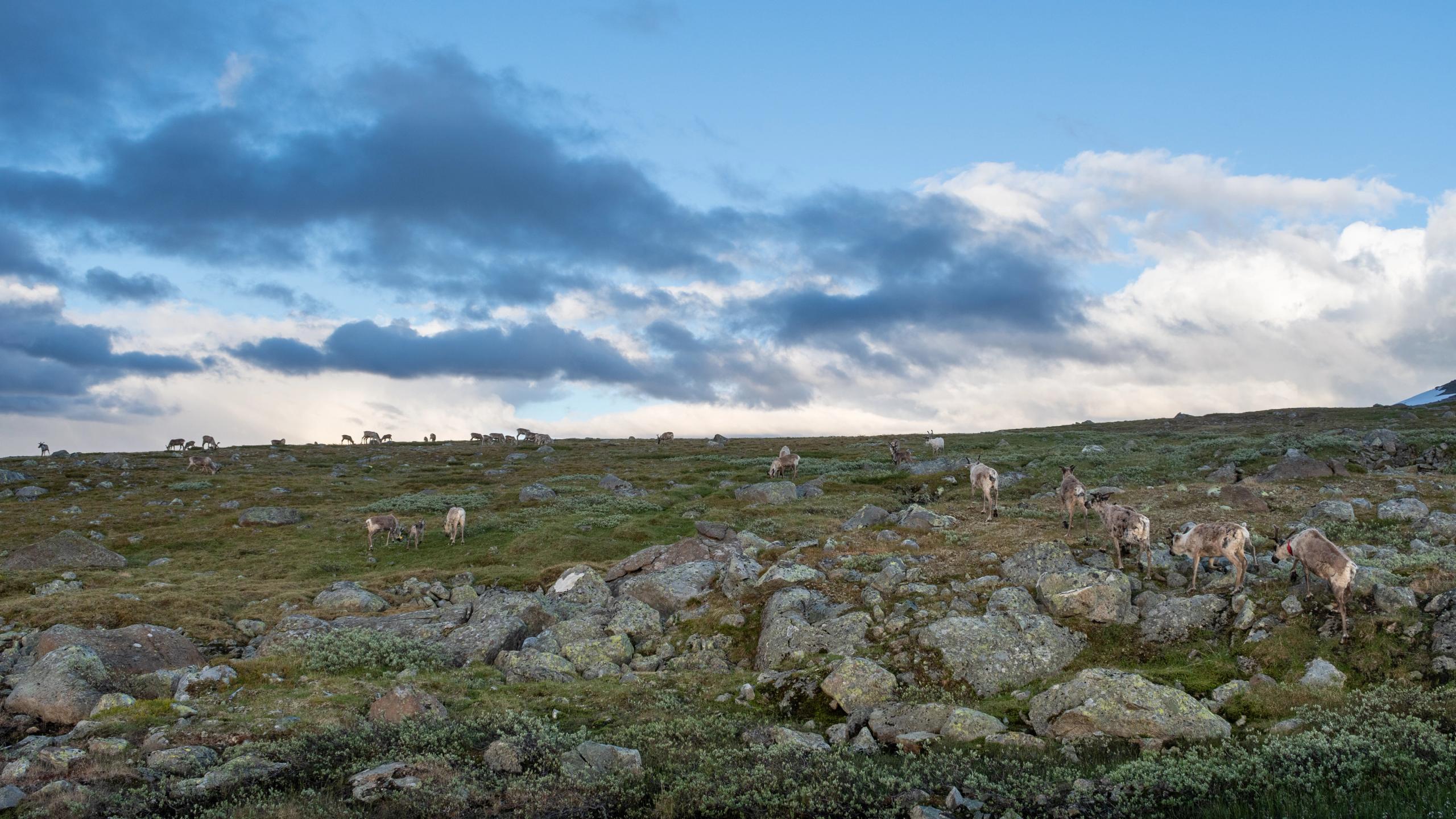
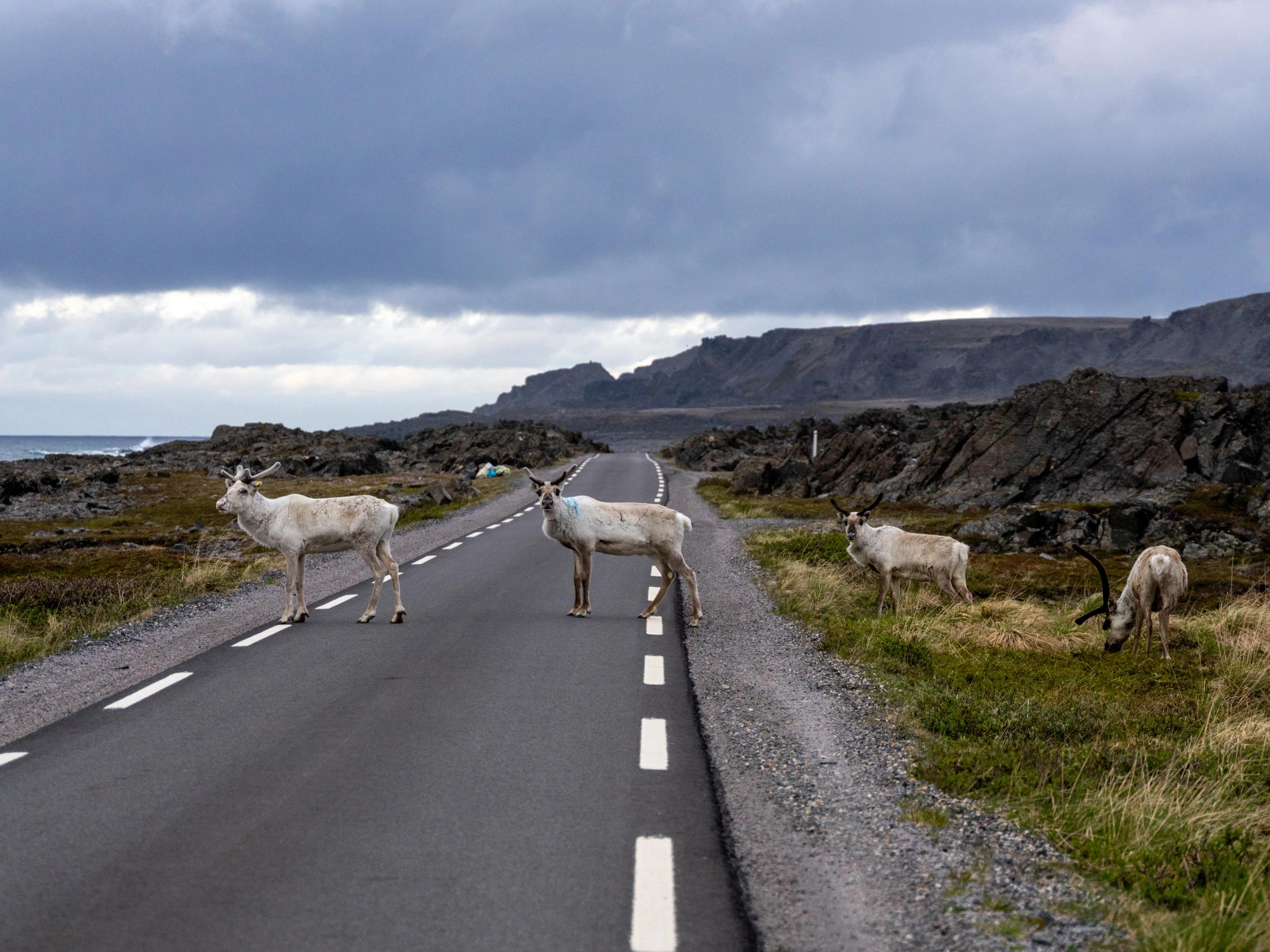
Remember, always keep an eye out for reindeer along the road – and keep your distance if you see them while hiking.
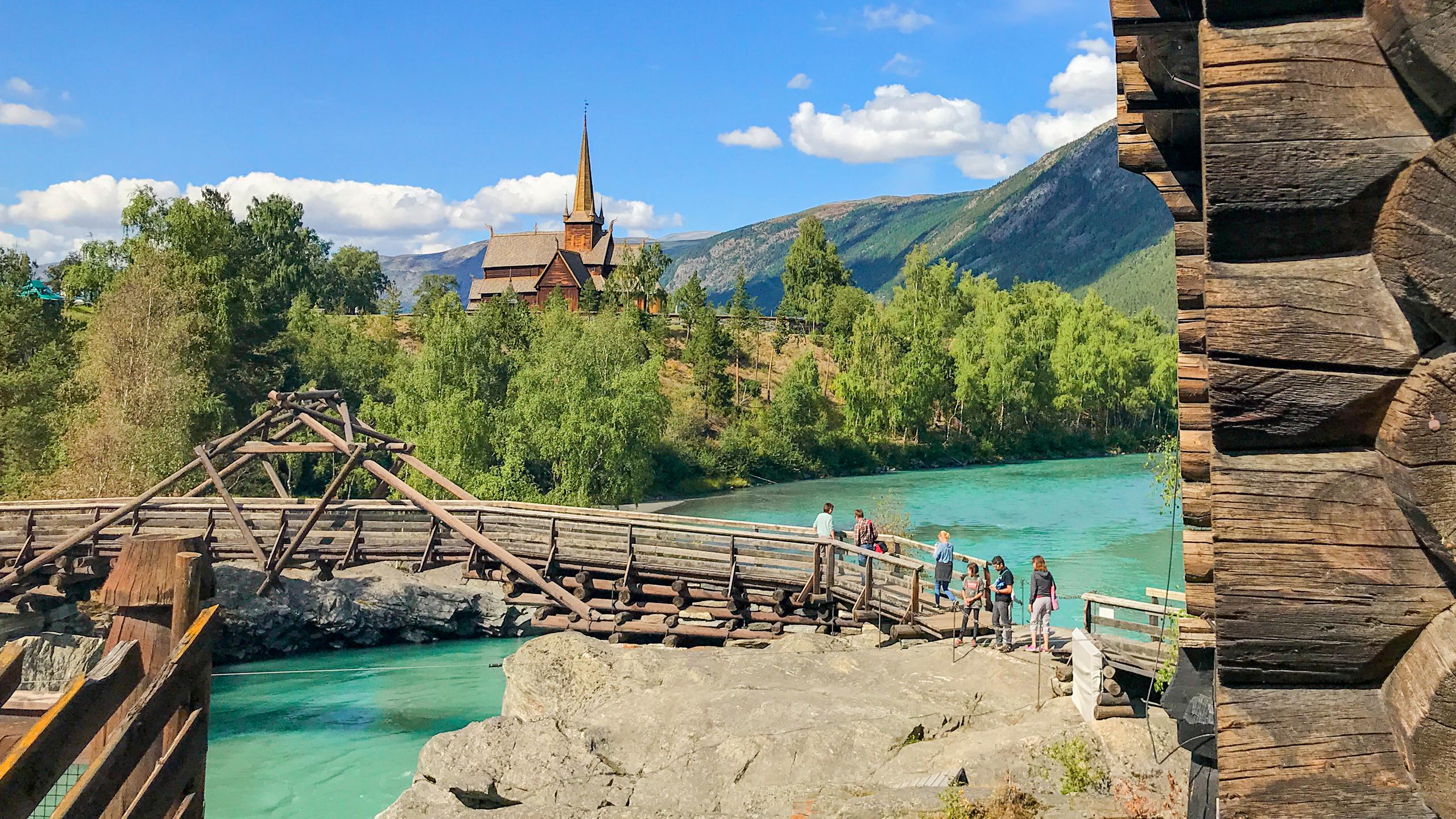
Continue down to Lom and the Ottadalen valley for the ultimate trip!
And explore more of the Jotunheimen mountains.
The Valdresflye Scenic Route
Discover the highlights!
Discover more
 9 Days ・ All yearBook now
Fjords & Hurtigruten
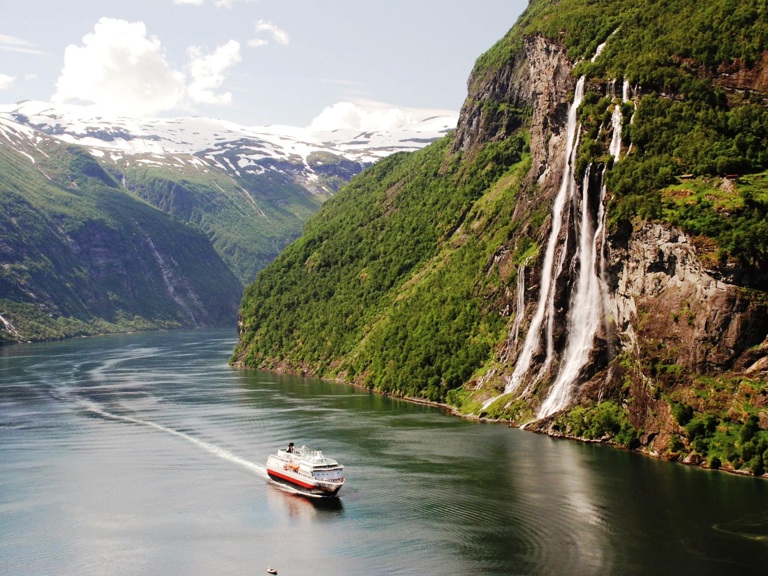
Fjords, scenic railways & coastal cruiseEmbark on a 2-day Norwegian coastal cruise, visit Bergen, Oslo, Trondheim, the Nærøyfjord, the Geirangerfjord (summer) or Hjørundfjord (autumn) and ride the scenic Bergen, Flåm and Dovre Railways. / Authentic ScandinaviaPrice From 16 630 NOK 2 Days ・ November - MarchBook now
Winter Fjords & Flåm from Bergen
Discover the fjords in winterExperience the fjords in winter on a scenic 2-day trip from Bergen to Flåm, with beautiful views, fjord cruise, mountain scenery and a stay at Fretheim Hotel. / Fjord ToursPrice From 4 983 NOK 2 Days ・ November - MarchBook now
Winter Fjords & Flåm from Oslo
Discover the fjords in winterCross Norway by train and fjord cruise on a scenic winter journey from Oslo to Bergen, with snowy mountain views, a night in Flåm and the UNESCO-listed Nærøyfjord. / Fjord ToursPrice From 5 526 NOK 4+ Days ・ September - MarchBook now
Short winter cruise
Tromsø and a Hurtigruten CruiseThis tour includes a cruise with Hurtigruten. Choose from a wide selection of winter activities including dog sledding and northern lights excursions. / Authentic ScandinaviaPrice From 7 355 NOK 6+ Days ・ September - MarchBook now
Northern lights cruise
Tromsø, the North Cape and KirkenesTour including a return cruise from Tromsø to Kirkenes with Hurtigruten. Visit the North Cape and try winter activities including dog sledding and snowmobiling. / Authentic ScandinaviaPrice From 14 500 NOK 6+ Days ・ November - MarchBook now
Arctic winter adventure
Snowhotel Kirkenes, Hurtigruten & TromsøWinter adventure tour including an overnight stay at Kirkenes Snow Hotel, a cruise with Hurtigruten to Tromsø, and a wide selection of optional winter activities. / Authentic ScandinaviaPrice From 14 345 NOK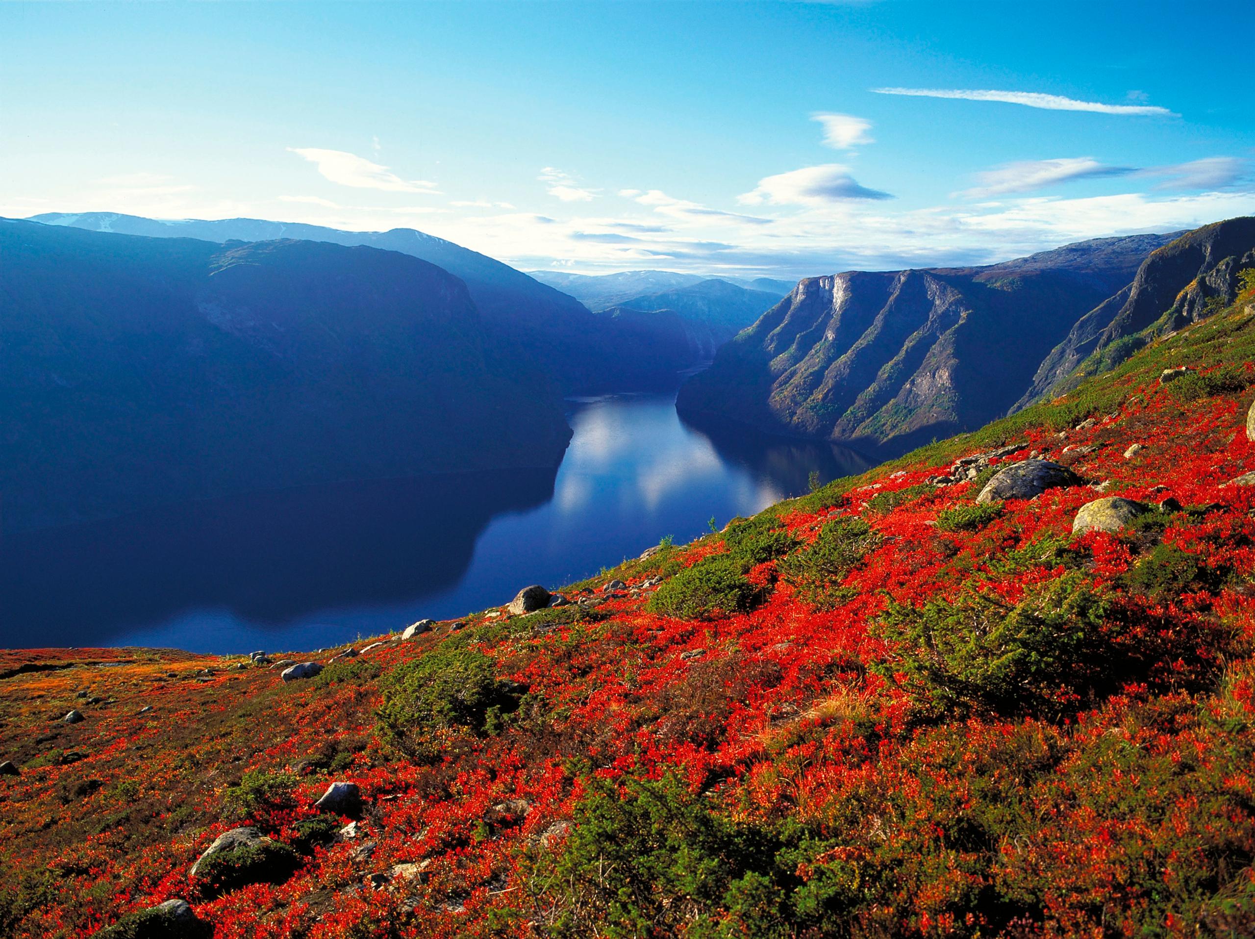 7+ Days ・ April - OctoberBook now
Sognefjord adventure
Oslo, Bergen, Flåm and BalestrandTravel independently by train and boat to experience the breathtaking Norwegian fjords. Visit Oslo and Bergen, as well as the fjord villages of Flåm and Balestrand. / Authentic ScandinaviaPrice From 11 490 NOK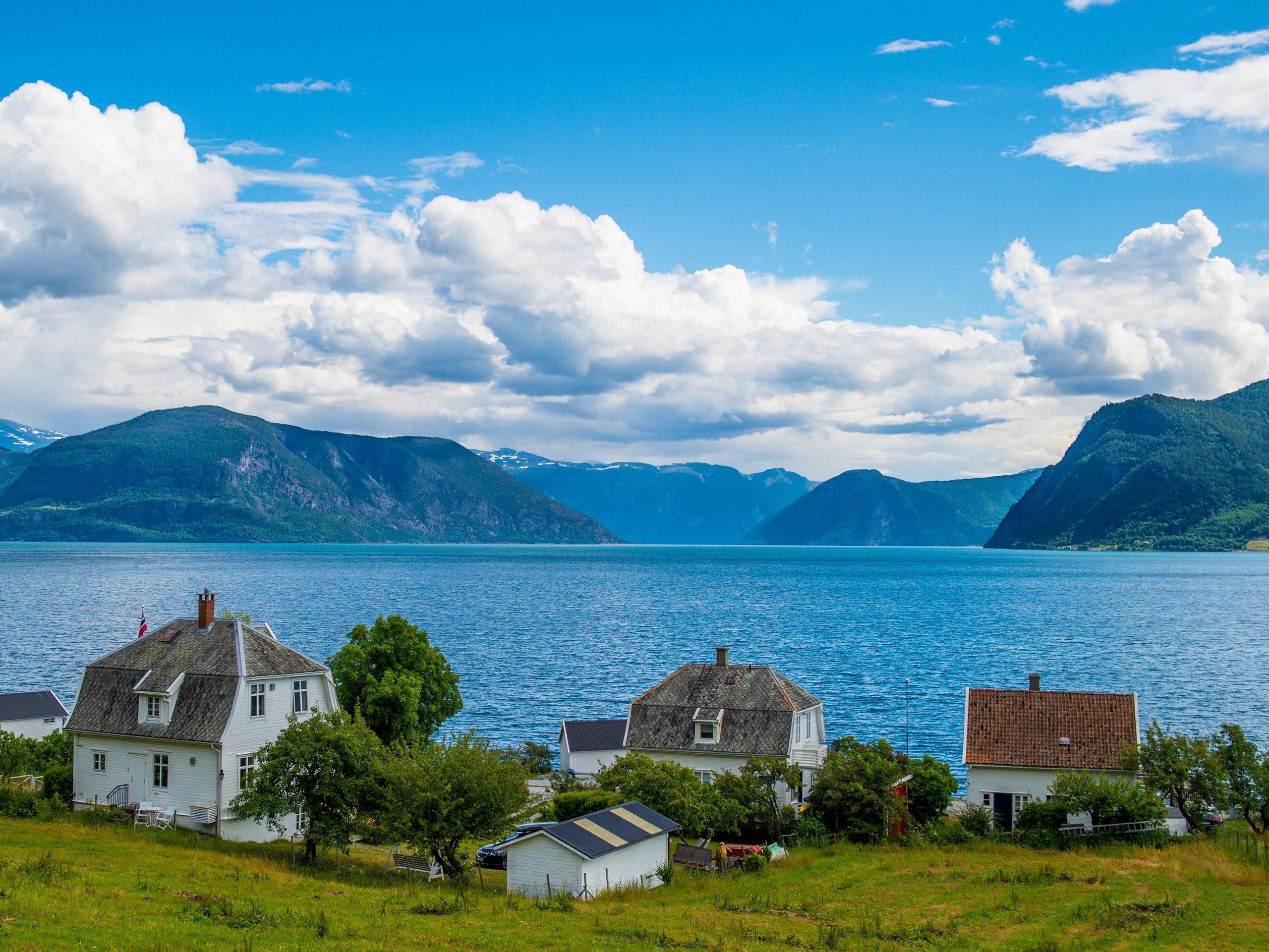 8+ Days ・ May - SeptemberBook now
Norwegian fjords & glaciers
Oslo, Bergen, Sognefjord, Hardangerfjord.Travel by train, boat, and bus to experience the Sognefjord and Hardangerfjord. Visit Oslo, Bergen, and the fjord villages of Flåm, Balestrand and Ulvik. / Authentic ScandinaviaPrice From 17 460 NOK 9+ Days ・ All yearBook now
Coast & fjords of Norway
Oslo, Bergen, fjords, Pulpit RockExperience the highlights of Southern Norway, including the Norwegian fjords and coast, scenic railways, the Pulpit Rock and the cities of Oslo, Bergen, Stavanger, and Kristiansand. / Authentic ScandinaviaPrice From 16 775 NOK 4+ Days ・ All yearBook now
Oslo, Bergen & fjord experience
Oslo, Flåm & BergenExperience the amazing Norwegian fjords. Travel by train on the Bergen & Flåm Railways, spend the night in beautiful Flåm, and join a cruise on the Nærøyfjord. / Authentic ScandinaviaPrice From 6 745 NOK 17 Days ・ May - SeptemberBook now
Escorted tour Oslo - Bergen - Trondheim
Visit the stave church at Lom and experience the Sognefjord and Gudbrandsdalen valleyJoin the Norway in a Nutshell journey, with ride on scenic trains and express boats along the coast, and enjoy two skylift gondola rides and scenic routes, including Trollstigen. / 50 Degrees North NordicPrice From 68 975 NOK 10 Days ・ June - SeptemberBook now
Scenic fjords of Norway
Experience the fjords on this premium group tourTour the Western Fjords of Norway, starting from Bergen and finishing in Trondheim on this escorted tour. Travel along the coast on an express boat before driving the Trollstigen Road and Atlantic Highway. Stay in historic waterfront and fjord hotels along the way. / 50 Degrees North NordicPrice From 43 835 NOK 1+ Days ・ All yearBook now
Norway in a Nutshell®
Norway's most popular tourThis legendary tour takes you through Norway’s most breathtaking UNESCO-listed fjord and mountain scenery, and includes a ride one of Europe’s top scenic rail journeys. / Fjord ToursPrice From 2 698 NOK 1+ Days ・ April - OctoberBook now
Sognefjord in a Nutshell™
Experience Sognefjord by rail and cruiseTravel the waterway into the heart of the Norwegian fjord- and mountain landscape and experience the beautiful Sognefjord. This relaxing fjord experience also includes scenic train journeys with the Flåm Railway and Bergen Railway. / Fjord ToursPrice From 2 745 NOK 12+ Days ・ All yearBook now
Grand tour of Norway
Oslo, Flåm, Bergen & Hurtigruten cruiseAn amazing rail tour from Oslo via the Norwegian fjords to Bergen. From Bergen you will continue on a 7-day cruise through incredible scenery along the Norwegian coast to Kirkenes. / Authentic ScandinaviaPrice From 23 205 NOK 8 Days ・ May - SeptemberBook now
Beautiful Norway
Touring Fjord Norway on our premium mini-coachIndependent tour from Oslo to Bergen using our premium mini-coach to explore 'off the beaten track' fjord locations. / 50 Degrees North NordicPrice From 23 875 NOK 10 Days ・ June - SeptemberBook now
Give me Møre!
A beautiful shortcutThe world’s most beautiful shortcut – from east to northwest through the Norwegian sierra. Recharge your batteries in stunning, ever-changing surroundings - relax and gain new perspectives. / Up NorwayPrice From 43 450 NOK 7 Days ・ June - SeptemberBook now
Far out in Svalbard
A remote Arctic adventureSvalbard – 1300 km (810 miles) from the North Pole – is an escape from the escape. As one of the last great wildernesses, Svalbard takes the Norwegian experience to a whole new level. / Up NorwayPrice From 42 000 NOK 12 Days ・ March - OctoberBook now
Bergen, Ålesund & beyond
Fjords and UNESCO World Heritage SitesFind a place where time stands still, feel the wind gently touch your face, and taste the richness that lives in the soil. Discover people and places that touch your heart. / Up NorwayPrice From 87 450 NOK 12 Days ・ April - OctoberBook now
The Arctic circle region
Myths and Marvels in HelgelandOn this journey, you will immerse yourself in the mythical fairy tales of Norway, and become a part of the story of the eternally immortalised trolls in the peculiar mountains around you. / Up NorwayPrice From 53 100 NOK 12 Days ・ May - SeptemberBook now
The Arctic circle express
Slow Travel is Back in FashionTake your seat on an epic rail journey through tranquil landscapes peppered with majestic mountains, fjords and waterfalls – on foot, by boat or even in a kayak. / Up NorwayPrice From 59 000 NOK 13 Days ・ April - OctoberBook now
Norwegian folklore
Road-trip through entrancing landscapesExperience the same landscapes that have entranced Norway's most famous artists for centuries while travelling through mountains, fjords and coastal landscapes, and from cities to villages. / Up NorwayPrice From 67 100 NOK 6+ Days ・ September - MarchBook now
Fjords & northern lights
Oslo, Bergen, Flåm and TromsøWinter adventure. See the fjords and the Arctic city of Tromsø. Winter activities like dog sledding, a northern lights safari, and much more can be added. / Authentic ScandinaviaPrice From 10 170 NOK 6 Days ・ June - AugustBook now
Kviknes hotel, Norway fjords and Bergen
All the fjord favourites in one tourThis classic self-guided fjord tour will have you sailing under towering fjord cliffs and RIB boating along the stunning fjords. Explore Hanseatic heritage and enjoy the warm hospitality of Norway's former capital, Bergen. / 50 Degrees North NordicPrice From 19 072 NOK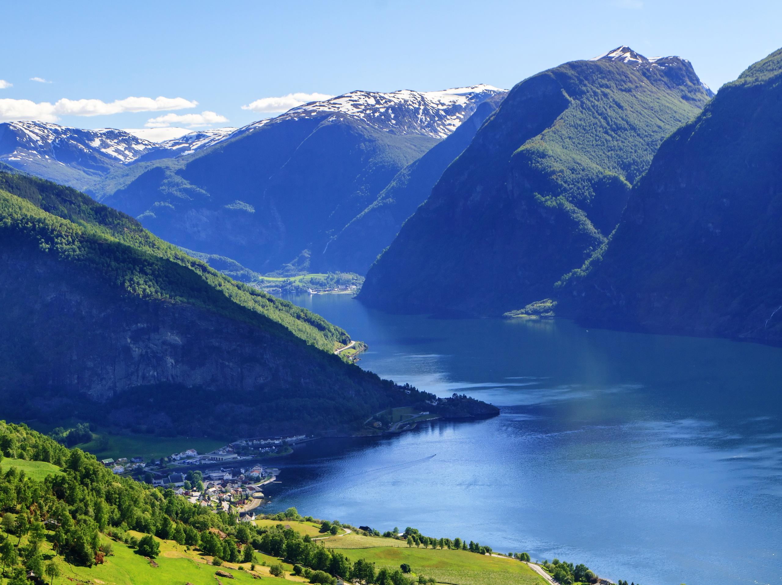 6+ Days ・ All yearBook now
Discover fjord Norway
Oslo, Bergen, fjords & mountainsIndependent rail tour including Oslo, Bergen and Vatnahalsen. Experience scenic railways and breathtaking fjords as you travel across the mountain to the Norwegian fjord region. / Authentic ScandinaviaPrice From 9 550 NOK 9+ Days ・ June - SeptemberBook now
The golden route
Oslo, Geiranger, Ålesund and Bergen.Explore Oslo, Geiranger, Ålesund, and Bergen on an independent rail tour. Travel with the impressive Rauma and Bergen Railway lines and enjoy a cruise with Hurtigruten on the Geirangerfjord. / Authentic ScandinaviaPrice From 19 945 NOK 10 Days ・ All yearBook now
Norway's super women
Can full equality ever be achieved?We have curated an itinerary that invites travellers to explore Norway from a gender equality perspective, and discover why Norway ranks so highly in the UN sustainable development chart. / Up NorwayPrice From 53 000 NOK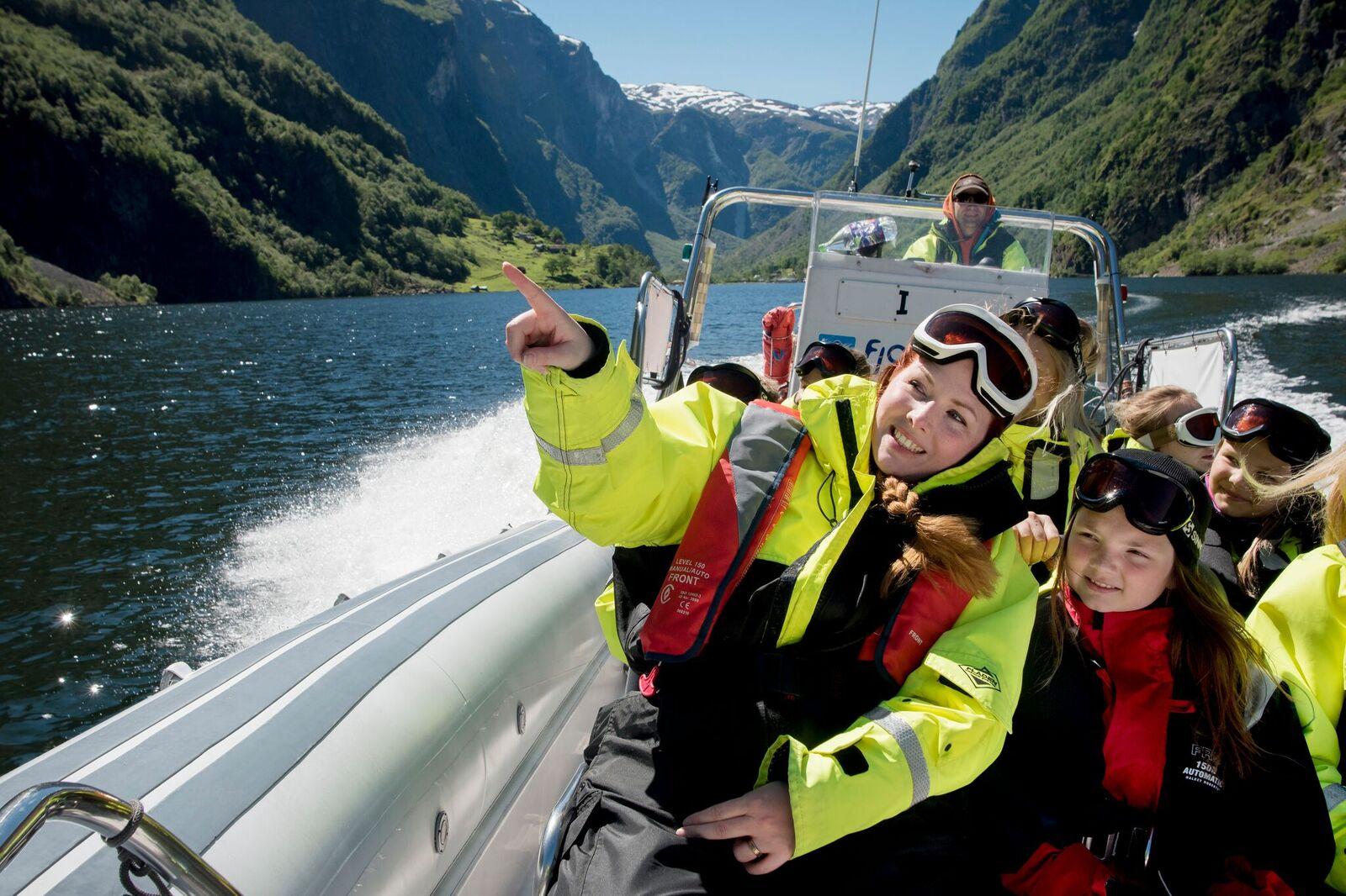 6+ Days ・ June - SeptemberBook now
Oslo & fjord adventure
Oslo, Bergen, downhill biking & fjord safari.Norway activity tour including Oslo, the Norwegian fjord region, Voss, and Bergen. Experience activities like cycling, fjord safaris by RIB boat, and spectacular train journeys. / Authentic ScandinaviaPrice From 12 510 NOK 11 Days ・ April - SeptemberBook now
Norwegian Havila voyage
Bergen to Tromsø with an overnight stay in LofotenThis Norwegian Coastal Voyage from Bergen stops in at Ålesund, Geirangerfjord, Trondheim, and Saltstraumen, then disembarks for an overnight stay in Lofoten before continuing to Tromsø. / 50 Degrees North NordicPrice From 26 215 NOK 7 Days ・ All yearBook now
Norway for foodies
A road trip in and around TrondheimThis journey includes tasty culinary experiences: tastings and talks on biodynamic farming, microbrews, local food, foraging, sustainable food production, and Norwegian culinary traditions. Delicious! / Up NorwayPrice From 42 900 NOK 7 Days ・ September - AprilBook now
Lofoten Islands and Manshausen
The perfect autumn or spring adventureSteigen and the Lofoten Islands make up the perfect autumn or spring travel adventure for those seeking an authentic immersion in Norwegian culture, nature, architecture, art and design. / Up NorwayPrice From 47 850 NOK 10 Days ・ April - OctoberBook now
New views of the old country
Oslo, Finse, Balestrand, Halvåg, BergenWho are you and where do you come from? The answer lies in the past. We invite you to embark on a journey of discovery where we will curate connections which may bring you much closer to your own ancestry. / Up NorwayPrice From 49 600 NOK 5 Days ・ Juni - SeptemberBook now
Aurland, Flåm and Hardanger
Fjord cruise, farm visits and Flåm railwayFjord cruise from Bergen through Sognefjord, farm visits with tastings, hike to get views of the Aurlandsfjord, enjoy a fjord sauna in Flåm, ride the famous Flåm Railway. Experience cider tasting in Hardanger, visit Rosendal Barony, and stay at quality hotels with 3-course dinners included. / Norrøna AdventurePrice From 28 500 NOK 8 Days ・ June - AugustBook now
From mountains to fjords
Jotunheimen and AurlandOn this adventure, you can hike the historical route through mountainous Jotunheimen National Park towards the beautiful fjords in the west. / Norrøna AdventurePrice From 26 000 NOK 6 Days ・ June - SeptemberBook now
Trolltunga, Preikestolen and Folgefonna glacier
Iconic hikes and Lysefjord cruiseOslo roundtrip: Hike Trolltunga and Preikestolen, explore Hardangervidda, walk on Folgefonna glacier (equipment provided). Cruise Lysefjorden and stay at Canvas Hotel with saunas and outdoor tubs. / Norrøna AdventurePrice From 29 000 NOK 24 Hours ・ All yearBook now
Flåm railway and cruise
A round trip to the fjordsExperience UNESCO-protected fjords with a self-guided round tour from Oslo. This trip includes the tickets Oslo-Myrdal-Flåm (train), Flåm-Bergen (boat, bus, train) and Bergen-Oslo (train) with sleeping compartment. / Booknordics.comPrice From 5 190 NOK 7 Days ・ All yearBook now
Roundtrip by cruise and rail
Complete holiday package from OsloExperience the Flåm Railway, cruise the Sognefjord and continue to Bergen. Cruise further to Stavanger and witness the Pulpit Rock, and visit picturesque towns on your return to Oslo by train. / Booknordics.comPrice From 19 220 NOK 8 Days ・ May - JulyBook now
Midnight sun tour
Group experience in Lofoten and SenjaIncludes sea eagle RIB safari, dining at award-winning Kvitnes Gård, visit to the Viking Museum, coastal cruise with Hurtigruten or Havila, tour to Hamn i Senja, and more. / 50 Degrees North NordicPrice From 49 652 NOK 2-3 Days ・ November - MarchBook now
Geirangerfjord in a Nutshell™ Winter Tour
UNESCO fjord, Rauma railway and fjord cruiseExperience the Geirangerfjord in winter. The trip includes a scenic train ride, a guided fjord cruise, and the Flydalsjuvet Viewpoint. You can personalize with activities and overnight stays. / Fjord ToursFrom 4 295 NOK 5 Days ・ All yearBook now
Norway Cities, Trains & Fjords
Including Norway in a Nutshell®A 5-day self-guided tour, that includes travel to Oslo, Bergen and Trondheim, some of the world’s most scenic railways, cruises on UNESCO fjords, and breathtaking coastal landscapes. / Fjord ToursPrice From NaN NOK 3 Days ・ May - SeptemberBook now
Sognefjord & Balestrand
Scenic journey between Oslo & Bergen3-day rail and fjord journey from Oslo or Bergen. Sleep 2 nights at historic Kviknes Hotel. Ride the Flåm Railway, cruise the Sognefjord, and visit Bøyabreen glacier. Includes an orchard lunch. / Fjord ToursPrice From 9 096 NOK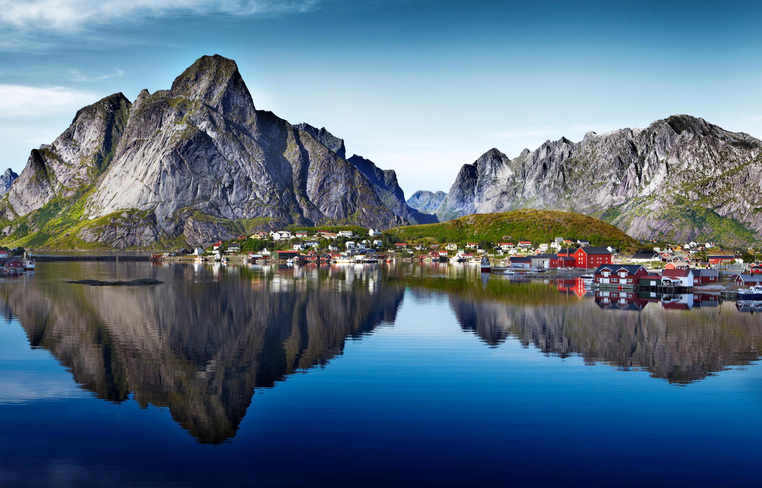 7 Days ・ June - AugustBook now
Tromsø, Senja & Lofoten
Arctic summer in Tromsø, Senja & SvolværEmbark on a self-guided bus tour of Tromsø, Senja & Lofoten. Visit charming villages off the beaten track and enjoy scenic backdrops of dramatic cliffs, crystal-clear bays and white sandy beaches. / Authentic ScandinaviaPrice From 8 785 NOK